

Colorado’s snowpack to suffer as bone dry conditions, more wind forecast for high country; where’s the snow?
Dry conditions will prevail for another six or seven days as Colorado’s high country continues to experience a dry fall heading into mid December.
Colorado’s snowpack remains growing inconsistently, marking the third year in last five to start below median average.
But snow is forecast to return about a week before Christmas, giving the possibility of the first fresh snow in 10+ days.
Recap:
Wednesday and Thursday continued to blow snow around in the high country where a peak gust of 81 mph was recorded at the Berthoud Pass summit on Thursday around 3 p.m.

The sun shone overall too, with high temperatures in the in the low 30s at most ski areas. Luckily, the sun is about as low of angle it can be with Earth so close to the solstice that any melting is limited to south facing slopes mainly.
Colorado’s snowpack:
Another dry spell is setting up to diminish Colorado’s snowpack over the next six or seven days.
Statewide snowpack is still close to 30% below median average and is currently following a similar path during winter 2023-24. That season ended about average, however, was a strong El Nino year and also contributed to the contiguous U.S. experiencing its warmest winter on record.
Early season dryness (October and November) is possibly becoming an influencing factor in low, overall snowpack for the season.
A study published from the Colorado Climate Center said only one year in the 21st century has been cooler than the 1971-2000 average. 2012 remains the state’s warmest year in the 128-year record, at 48.3°F (3.2°F warmer than the 1971-2000 average).
Furthermore, the greatest amount of warming in recent decades has occurred in the fall, with statewide temperatures increasing by 3.1°F from 1980-2022.
Three of the last five fall seasons (winter 21-22, 23-24 and 25-26) have delivered below average early-season snows.
According to the Colorado Climate, fall season (Sep-Oct-Nov) temperatures have warmed more than any other season for 1980-2022, +3.1 degrees in that time frame.
Forecast:
Friday to Wednesday look bone dry across Colorado’s high country. But then a shift to storminess is forecast to come Wednesday afternoon through Friday morning.
Saturday is forecast to be windy again, with gusts on ridge tops between 60-70 mph and at the ski areas between 20-30 mph and centered along the Front Range.
On Sunday and Monday, forecasted winds are to be less, however, windy conditions are forecast to return both Tuesday and Wednesday.
Snow is forecast to develop Wednesday afternoon in the northern and west-central mountains.
Forecasted snowfall accumulations in the northern mountains are between 1-4 inches, in the central mountains between 1-7 inches with the highest amounts near Monarch Pass, and in the southern mountains between 1-4 inches with the northern San Juan Mountains picking up the majority of snow.
Long-term forecast:
Current models show some light snow showers from next Friday to Tuesday, Dec. 23, mostly in the northern mountains.
Starting Wednesday, Dec. 24, a bigger storm could impact all three mountain zones heading into Christmas Day, Dec. 25.
More model runs will need to render to hone in on snowfall totals for this potential system, including timing and duration.
Colorado ski resorts’ planned opening dates and 24-hour totals:
Arapahoe Basin – 0″
Aspen Highlands – Dec. 13
Aspen Mountain – 0″
Beaver Creek – 0″
Breckenridge – 0″
Buttermilk – Dec. 13
Cooper – 0″
Copper Mountain – 0″
Crested Butte – 0″
Echo Mountain – 0″
Eldora Mountain – 0″
Granby Ranch – 0″
Hesperus – Closed for the season
Howelsen Hill – 0″
Kendall Mountain – Dec. 13
Keystone – 0″
Loveland – 0″
Monarch – 0″
Powderhorn – 0″
Purgatory – 0″
Silverton – Guided & Heli season Dec. 27
Snowmass – 0″
Steamboat – 0″
Sunlight – 0″
Telluride – 0″
Vail – 0″
Winter Park – 0″
Wolf Creek – 0″

Democrats confront shift as socialist-aligned candidates win races in Colorado
Thelma Grimes
thelma.grimes@coloradopolitics.com
Updated 22 hours ago
Democratic socialists’ recent electoral gains — punctuated by Melat Kiros’ victory on Tuesday over U.S. Rep. Diana DeGette, the dean of Colorado’s congressional delegation — are the result of a movement that has been taking shape in metro Denver for...
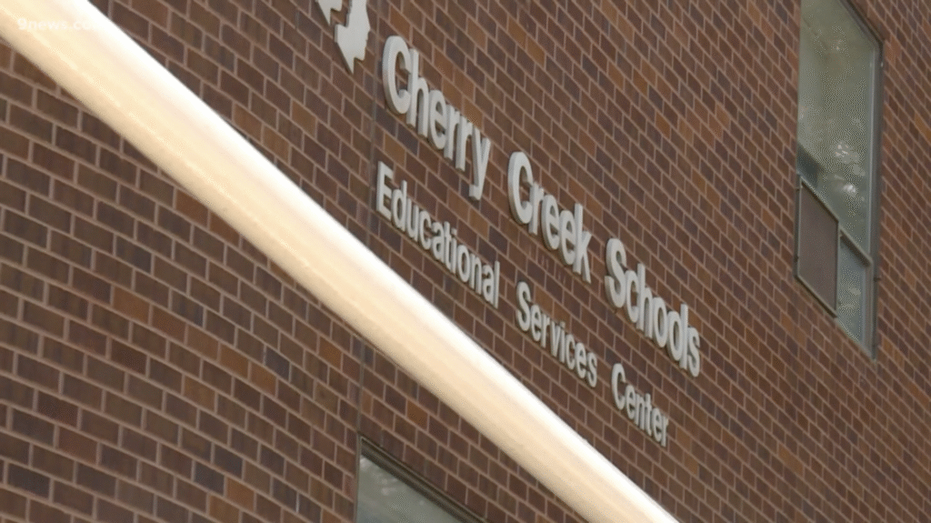
Cherry Creek spent $65K on investigation, but invoices remain secret, records show
Nico Brambila
nico.brambila@denvergazette.com
Updated 3 days ago
After previously refusing to disclose the cost associated with the investigation into the former superintendent and his wife, the former human resources chief, Cherry Creek School District officials partially released records showing the cost to taxpayers: $65,054.85. The Denver Gazette...
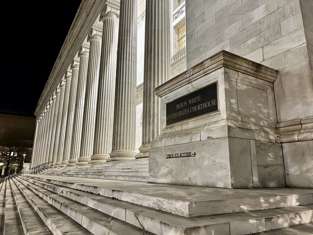
10th Circuit agrees Colorado satisfied jury award after intercepting money for restitution
Michael Karlik
michael.karlik@coloradopolitics.com
Updated 3 days ago
The Denver-based federal appeals court agreed last week that Colorado satisfied its obligations by not paying a man directly for violating his rights, but rather crediting the jury’s multimillion-dollar award toward the crime victim restitution he still owed in his...
Colorado business confidence improves but still pessimistic
Bernadette Berdychowski
bernadette.berdychowski@denvergazette.com
Updated 3 days ago
Halfway into the year, business confidence across Colorado has improved but is still negative, a new report found. The Leeds Business Confidence Index, a measurement of how business leaders across Colorado feel about the future of the national and state...
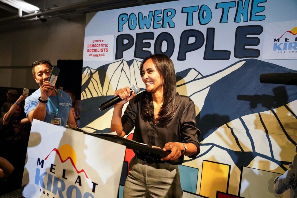
How Melat Kiros pulled Democratic Party left in upset win over Diana DeGette
Ernest Luning
ernest.luning@coloradopolitics.com
Updated 3 days ago
“It’s time for change,” Democratic congressional candidate Melat Kiros, a political newcomer and self-described democratic socialist, said in her campaign’s TV ad. On Tuesday night, primary voters in Denver agreed, giving the nomination to the 29-year-old, while at the same...
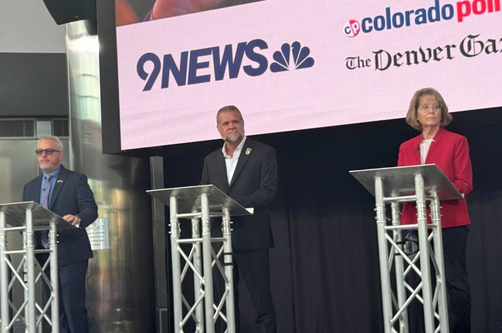
Victor Marx’s lead sits outside of recount threshold in Republican race for Colorado governor
Luige DelPuerto
luige.delpuerto@gazette.com
Updated 4 days ago
Ministry leader Victor Marx on Wednesday night overtook state Sen. Barb Kirkmeyer in the Republican primary for Colorado governor, securing enough votes that — for now — put the race beyond the mandatory recount threshold. The Republican primary race between Kirkmeyer...

Large Colorado counties hunker down to count ballots as Republican race for governor tightens
Marissa Ventrelli
marissa.ventrelli@coloradopolitics.com
Updated 4 days ago
Nearly 24 hours after ballot boxes closed for Colorado’s 2026 primary election, the Republican nominee for governor remained undecided as counties hunker down to tally more ballots. As of 3 p.m. Wednesday, several counties were still processing tens of thousands...
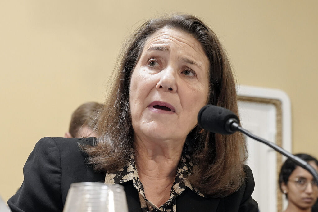
Colorado’s Diana DeGette concedes defeat to Democratic socialist Melat Kiros
Ernest Luning
ernest.luning@coloradopolitics.com
Updated 4 days ago
U.S. Rep. Diana DeGette — the dean of Colorado’s congressional delegation — conceded defeat in the race for the 1st Congressional District a day after losing to Democrat rival Melat Kiros in their party’s primary contest. “I want to congratulate...
Progressive Democrats, traditional Republicans secure state House victories in Colorado
Marianne Goodland
marianne.goodland@coloradopolitics.com
Updated 4 days ago
With ballots still being counted, results from Tuesday’s primary election remained up in the air for several candidates for the Colorado General Assembly. Still, the preliminary results as of Wednesday morning showed progressive Democrats had a good night, as did...

5 takeaways from Colorado’s shocker of a 2026 primary election
Ernest Luning
ernest.luning@coloradopolitics.com
Updated 4 days ago
Voters in Colorado’s Democratic primary on Tuesday night mostly let their elected officials know that they’re fed up with the party’s Washington politicians and ready to back the most aggressive fighters they can find. At the same time, the voters...
PREV
PREVIOUS

Trump signs executive order to block state AI regulations
President Donald Trump signed an executive order Thursday aimed at blocking states from crafting their own regulations for artificial intelligence, saying the burgeoning industry is at risk of being stifled by a patchwork of onerous rules while in a battle with Chinese competitors for supremacy. Members of Congress from both parties, as well as civil […]

'Deep source of pride': Federal judge speaks about first year on bench, how he spends his time
One of Colorado’s newest federal judges spoke on Thursday about his first year on the bench, his philosophy behind facilitating case settlements and how his background as a public defender informs his current role. “Most of my career, I represented poor people or people who didn’t have enough money for an attorney,” said U.S. Magistrate […]