

Colorado Wildfires | A look at the fires burning in the state
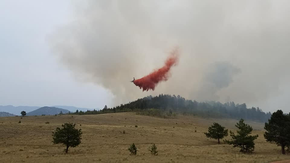
Here’s a look at the size and other stats about Colorado’s wildfires, including the new Thorpe fire in Park County.
Grizzly Creek fire
Acres/Location: 32,060 acres/Glenwood Canyon
Containment: 61%
Started: Aug. 10, human caused
Firefighters: 775
Interstate 70 re-opened for through traffic between Gypsum and Glenwood Springs Monday after a short closure when the fire flared-up. Drivers are encouraged to be extremely careful and to drive slowly. No stopping is allowed and rest areas are closed. More sporadic closures are expected as mudslides and other events occur.
Flare ups in the center of the fire are possible as high temperatures, low moisture and windy conditions persist.
RELATED:
– Fire reported near Bishop Castle; pre-evacuation order issue for Willis Creek fire
– Ash raining down on Colorado a sign of hotter, drier and more dangerous fire seasons
–Grizzly Creek fire increases flood risk in Glenwood Canyon
–Gov. Polis activates National Guard to assist with wildfire response
Pine Gulch fire
Acres/Location: 135,903/18 miles north of Grand Junction
Containment: 47%
Started: July 31, lightning
Firefighters: 932
Pine Gulch fire progression map
Burning north of Grand Junction, the fire continued to grow and became the second largest fire in Colorado history, behind only the 2002 Hayman fire.
Tuesday the fire became the state’s top priority fire, replacing the Grizzly Creek fire, as energy infrastructure is at risk.
Wind gusts up to 27 mph are expected Tuesday with temperatures near the low 90s. Thunderstorms forecast throughout the week pose a concern for high winds and lightening. But moistening rains could also follow.
Williams Fork fire
Acres/Location: 11,266/seven miles southwest of Fraser in the Arapaho and Roosevelt National Forests
Containment: 5%
Started: Aug. 14, human caused
Firefighters: 298
The fire threatened Henderson Mine and Mill but moved away from Fraser, Tabernash and Winter Park according to the U.S. Forest Service. Firefighters worked to create containment lines around the mine and mill Tuesday.
The fire is burning dry beetle-killed timber and is expected to continue until wetting rains or snow stop the flames.
Cameron Peak fire
Acres/Location: 21,017/West of Fort Collins, Arapaho and Roosevelt National Forests
Containment: zero percent
Started: Aug. 13, unknown cause
Firefighters: 722
Storms brought gusty winds Monday.
The fire still burned beetle-killed timber and threatened the City of Fort Collins water source.
Thorpe fire
Acres/location: 159/Pike and San Isabel National Forest, South Park Ranger District, off Forest Service Road 230 and Park County Road, west of Lake George.
Containment: 50%
Started: 1 p.m. Sunday, unknown cause
Firefighters: Forest Service fire resources including one bulldozer, one type 3 helicopter, three large air tankers and one very large air tanker
Crews continued to use natural and man-made barriers to contain the fire.
Two subdivisions in the Weber Park area received evacuation notices as the small blaze moved through grass and timber. There have been no reports of injuries, but some structures are threatened.
Evacuations were lifted late Monday, but residents remained on pre-evacuation status.
Lewstone fire
Acres/location: 165/Rist Canyon 15 miles northwest of Fort Collins
Containment: 100%
Firefighters: 100
Started: 2:30 p.m. Saturday, unknown cause
No air support was ordered Tuesday.
SCOTUS arguments, varied workload: 6 Colorado solicitors general talk about job
Michael Karlik
michael.karlik@coloradopolitics.com
Updated 36 minutes ago
Six current and former solicitors general of Colorado, including two who have since become members of the bench, spoke to attorneys on Wednesday about how the role has changed over time, what the workload entails, and their experiences arguing at...

Colorado space startup secures $650 million for expansion
alex-edwards
alex.edwards@gazette.com
Updated 2 hours ago
The window to deliver space superiority for the U.S. is open but shrinking rapidly, according to defense startup True Anomaly. The Centennial-based company hit a milestone in its pursuit to help deliver that, announcing Tuesday that it raised $650 million...

Denver public safety power shut-offs ‘a last resort,’ Xcel says
Deborah Grigsby
deborah.smith@denvergazette.com
Updated 2 hours ago
Although Denver has not yet experienced a public safety power shut-off, the Mile High City came close in December, according to Xcel Energy officials who briefed the city’s Transportation and Infrastructure committee Wednesday. Representatives from the utility company briefed members...

12 finalists selected to interview for Aurora Colfax revitalization board
Kyla Pearce
kyla.pearce@gazette.com
Updated 2 hours ago
Twelve finalists, including several area business owners, will interview for Aurora’s Downtown Development Authority Board in early May to form the oversight body for a project to revitalize Colfax Avenue. Aurora officials received 38 applications for the six board positions,...

Federal judge declines to end Denver sheriff employee’s sex discrimination suit
Michael Karlik
michael.karlik@coloradopolitics.com
Updated 2 hours ago
A federal judge tentatively green-lit a former Denver Sheriff Department sergeant’s sex discrimination lawsuit for trial last month, based upon allegations that three female employees were promoted ahead of him despite his qualifications. U.S. District Court Judge Nina Y. Wang...

Selling dogs, cats in pet stores now banned in Colorado
Marissa Ventrelli
marissa.ventrelli@coloradopolitics.com
Updated 19 hours ago
Gov. Jared Polis signed a bill into law on Wednesday prohibiting pet stores from selling dogs and cats, which sponsors have nicknamed the “Pistol the Pomeranian Protection Act.” House Bill 1011, sponsored by House Majority Leader Monica Duran, D-Wheat Ridge,...

Colorado bill allowing THC beverages to be sold at grocery stores, restaurants pulled by sponsor
Marissa Ventrelli
marissa.ventrelli@coloradopolitics.com
Updated 20 hours ago
A Denver Democrat decided on Tuesday to pull a proposal that would have allowed beverages with tetrahydrocannabinol or THC to be sold at locations like grocery stores, restaurants, and entertainment venues. THC is the psychoactive substance in cannabis, the chemical...
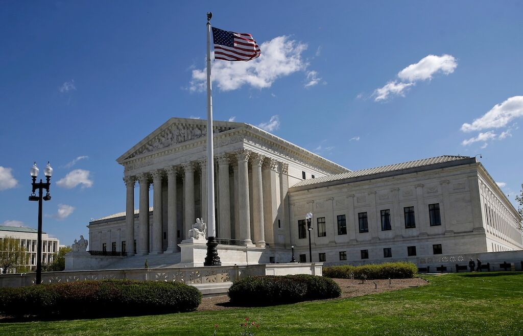
Democrats ready to fight after Supreme Court strikes down voting rights case
Lauren Green and Mabinty Quarshie, Washington Examiner
lauren.green.and.mabinty.quarshie.washington.examiner@gazetteedit.wpenginepowered.com
Updated 19 hours ago
The 2026 House map has been flipped upside down by a massive Supreme Court decision Wednesday to overturn the parts of the Voting Rights Act, as Democrats remain ready to fight. The Supreme Court dealt a blow to race-based redistricting,...

Blanche says Trump did not direct DOJ to indict Comey a second time
David Zimmermann Washington Examiner
davidzimmermannwashingtonexaminer@wpstage.coloradopolitics.com
Updated 19 hours ago
Acting Attorney General Todd Blanche on Wednesday denied that President Donald Trump directed the Justice Department to indict former FBI Director James Comey for a second time, saying the investigation has been ongoing for almost a year. The two-count indictment...

Corrections officials may be sued for employee’s alleged abuse of detainee, federal judge rules
Michael Karlik
michael.karlik@coloradopolitics.com
Updated 22 hours ago
High-level corrections officials may be sued for their own alleged failures to prevent or respond to an employee’s sexual misconduct toward a detainee, a federal judge decided last month. Rajae Bouhamidi was incarcerated at the Denver Women’s Correctional Facility. In...
PREV
PREVIOUS

State health department urges radon testing as people continue to stay home
As the still-surging COVID-19 pandemic forces people to remain home five months after the first official stay-at-home orders went into effect, the Colorado Department of Public Health and Environment is urging people to test their homes for radon. “Testing your home for radon is simple and inexpensive,” said Chrystine Kelley, the department’s radon program manager. […]
Capitol, other Colorado landmarks to light up in honor of 19th Amendment
Purple and gold lights will illuminate the state capitol on Wednesday to celebrate the 100th anniversary of the adoption of the 19th Amendment, which outlawed sex discrimination in voting. “This is an inspirational anniversary to celebrate how Colorado has been a trailblazer on expanding access to the ballot box,” Gov. Jared Polis said. “In 1893, […]