

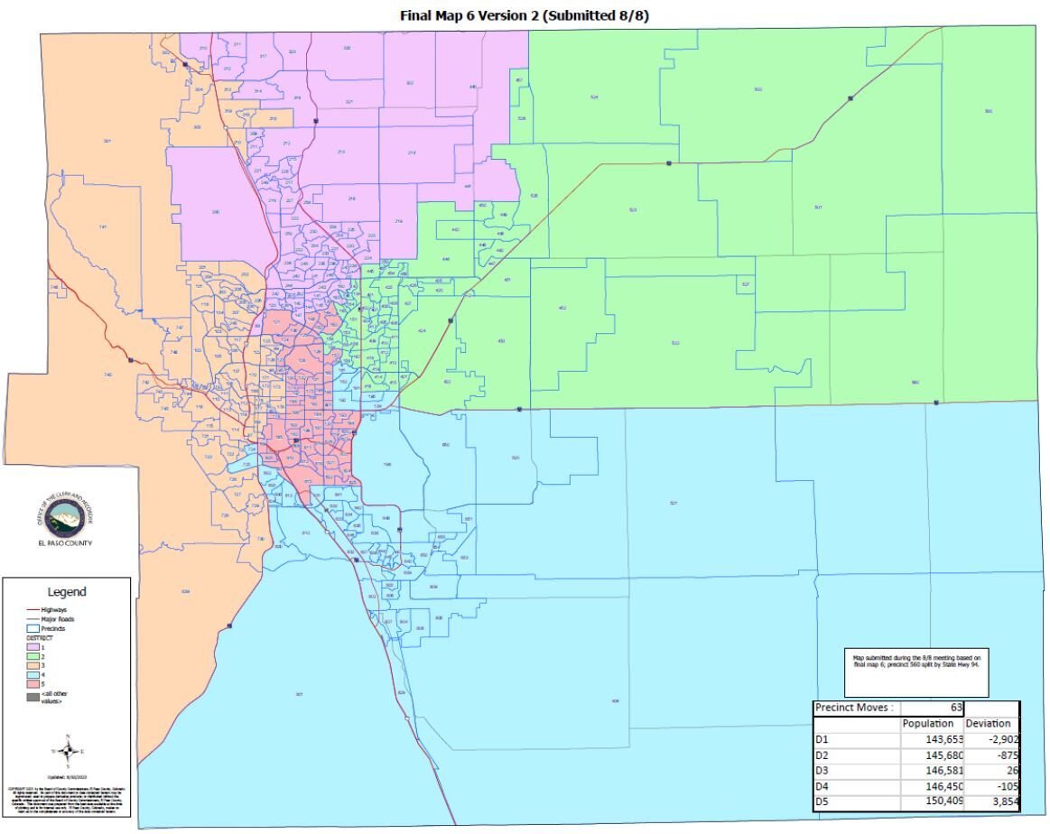
El Paso County Redistricting Commission finalizes new commission districts; not all pleased
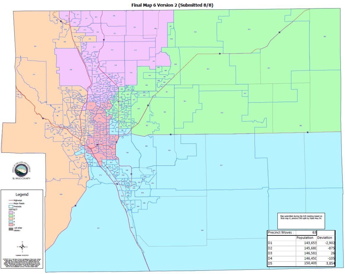
In the culmination of a monthslong contention among competing racial, military and geographic communities of interest, the El Paso County Redistricting Commission has selected a final map outlining new commissioner districts.
The redistricting commission, consisting of the five members of the El Paso County Board of Commissioners, said it selected the map from three finalists, because it best accommodated the needs of the most prominent “communities of interest” – including keeping Fountain and Fort Carson in one district and consolidating southeast Colorado Springs precincts in another – brought forth by residents over the four-month process.
The request to keep together southeast Colorado Springs, defined by residents as a group of 30 voter precincts west and northwest of the Colorado Springs Airport that each have a minority population of 45% or greater, dominated public input.
The move could lead to a potentially further left-leaning district, laying the foundation for election of the first Democratic county commissioner in 50 years.
One other prominent resident request, however, was not included in the new map.
Many residents argued against joining Monument and Manitou Springs, Old Colorado City and other southwest communities in one district, District 3, claiming that the small business- and tourism industry-saturated west side, heavy with historic districts, does not align culturally or geographically with Monument.
Residents also said the move decreases competitiveness in District 3 – which Commissioner Stan VanderWerf narrowly won after a late push by his Democratic opponent in 2016 – in favor of Republicans.
“You opted to put yourselves in that very difficult position of operating against your instincts,” said former state Sen. Pete Lee, a Democrat from Colorado Springs and current resident of District 3. Lee sponsored the 2021 House bill that outlines county redistricting guidelines, which encourages the use of an independent advisory commission during the process.
“When I see the map with District 3 containing those orphan detached (Monument) precincts, it seems to violate the basic rules of contiguity and a classic case of gerrymandering,” Lee said.
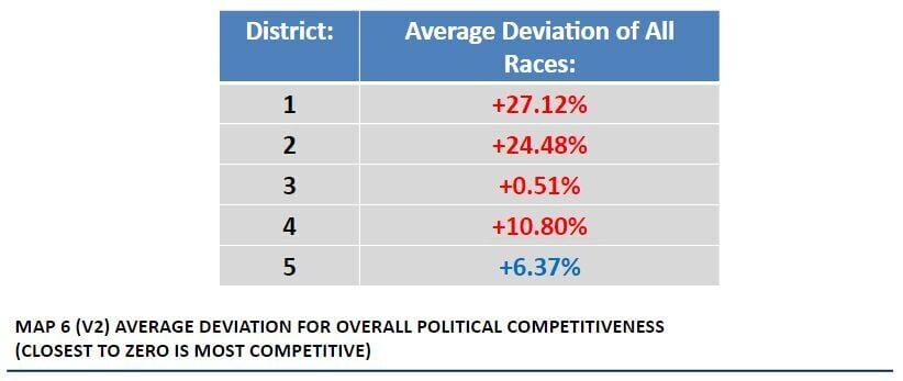
According to data presented Tuesday by county Clerk and Recorder Steve Schleiker, District 3 is now the most politically competitive district on average, with a deviation from zero – or “even” competitiveness – of just under 1% in favor of Republicans. District 1, encompassing much of northern El Paso County, is the least competitive and most heavily in favor of Republicans, while District 5 – where the 30 southeast precincts sit – now leans in favor of Democrats.
The new map was selected from three maps designated Aug. 8, none of which were taken from a number of publicly submitted resident maps on the county’s online redistricting portal.
“The maps that we have here were maps that originated with commissioners … they were not maps that originated with any of the citizens or groups that worked together to put maps together,” Amy Paschal, a District 3 resident, said Tuesday. “All of those maps were dropped out of consideration, and that’s really unfortunate when the whole point of this process was to get more … than just the commissioners’ ideas.”
VanderWerf on Tuesday said that given the vast number of interests in and the size of El Paso County, that give-and-take was inevitable and that the new map does accommodate many other resident requests, like keeping the Patty Jewett neighborhood in one district and keeping smaller municipalities intact.
Monument was split between two districts under the former map, he said.
Commissioners have routinely cited the wildland-urban interface, where wildfire-prone areas meet residential development from Manitou Springs to the Tri-Lakes region, as a crucial community of interest and reasoning for the move.
“We have actually incorporated a lot of features that were recommended to us,” VanderWerf said. “To be fair, it just wasn’t possible to recommend everything and, in fact, many of the (public) comments were in conflict with each other.”
District 2 Commissioner Carrie Geitner, who has been a staunch advocate for the Eastern Plains communities, said the inclusion of two less similar places is not unique to the west side.
“If you went and asked someone who lives in the town of Calhan what they have in common with someone who lives west of Powers (Boulevard), they might struggle a bit … it’s not as if there’s something unique going on in District 3,” Geitner said. “That is a natural consequence of living in a very large county that has a lot of different areas.”
Commissioners also opted for the final map because it better accommodates future growth than the other finalists.
According to Schleiker’s data, Districts 1, 2 and 4 are underpopulated, while Districts 3 and 5, which includes downtown Colorado Springs, are overpopulated due to relatively slow projected growth.
Click or tap here for the final map file.
Click or tap here for information on the new districts’ political competitiveness and racial demographic data.(tncms-asset)3cd62a64-37b4-11ee-b703-676ccb6a311b[3](/tncms-asset)
City Council approves controversial apartments for homeless young adults in Colorado Springs
Colorado’s ‘right to natural gas’ measure submits signatures to qualify for November ballot
Marissa Ventrelli
marissa.ventrelli@coloradopolitics.com
Updated 22 hours ago
A natural-gas rights initiative backed by Advance Colorado is likely headed to the November ballot, triggering a parallel campaign by environmental groups seeking to impose new liabilities on oil and gas operators. Petitions for Initiative No. 177 were turned in...
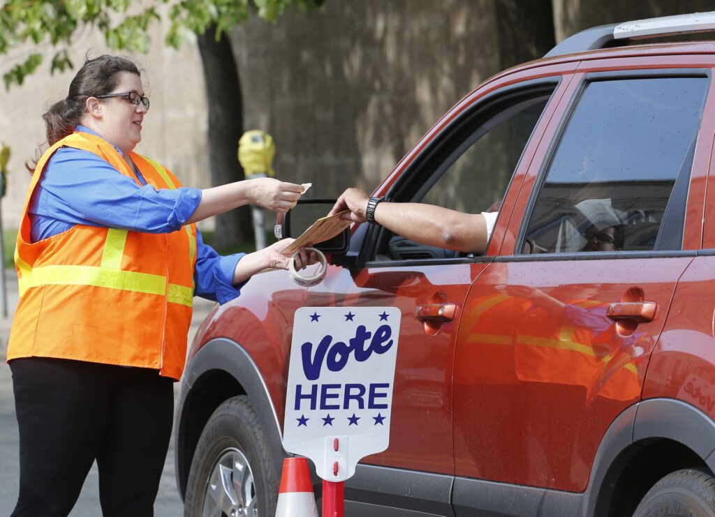
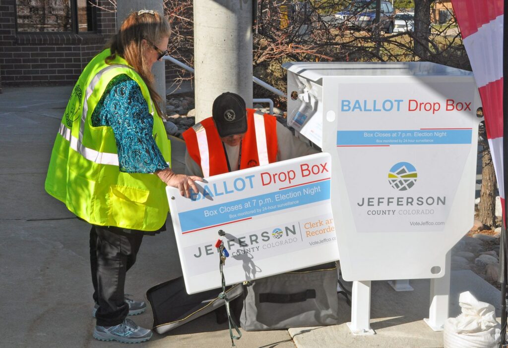
Colorado’s primary turnout tops 10% as election officials warn it’s too late to mail ballots
Ernest Luning
ernest.luning@coloradopolitics.com
Updated 17 hours ago
Colorado election officials cautioned on Tuesday that it’s too late to mail ballots for the June 30 primary and urged voters to use drop boxes and their county’s voting centers instead. Secretary of State Jena Griswold said in a release...

Rural frustration, parental rights shape Scott Bottoms’ pitch ahead of Colorado’s gubernatorial primaries
Thelma Grimes
thelma.grimes@coloradopolitics.com
Updated 2 days ago
With just weeks before Colorado’s June primary, Republican gubernatorial candidate state Rep. Scott Bottoms is spending nearly all his time on the road — literally crisscrossing the Western Slope and Eastern Plains — in a final push to connect with...
Registered voters on the eve of the 2026 primaries | Cronin & Loevy
Tom Cronin Bob Loevy
tom-cronin-bob-loevy@coloradopolitics.com
Updated 5 days ago
The Colorado Secretary of State’s Office has published the latest voter registration figures for the state and its counties as of June. Colorado ranks among the highest states for independent, or unaffiliated, voters. Only Alaska and Massachusetts have more. New Hampshire, New Jersey, Maine and Oregon also rank highly. So here...
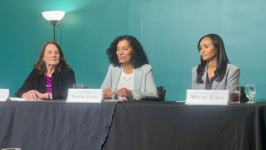
Democratic candidates DeGette, Kiros and James clash in CD1 forum
Marissa Ventrelli
marissa.ventrelli@coloradopolitics.com
Updated 3 days ago
The three Democratic candidates for Colorado’s 1st Congressional District clashed on Friday night over a host of issues, even as they expressed frustration with their party. The candidates — U.S. Rep. Diana DeGette, doctoral student Melat Kiros and university regent...
Rep. Jeff Crank thinks Democrats are too focused on Trump, not enough on Colorado Springs | Vince Bzdek
Vince Bzdek
vince.bzdek@gazette.com
Updated 4 days ago
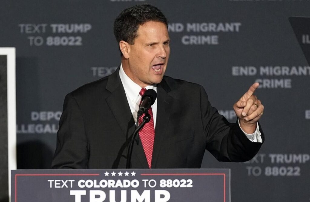
For U.S. Rep. Jeff Crank, who’s unopposed in the Republican primary for the 5th Congressional District but the main target of both candidates in the lively Democratic primary, the big question in the midterms is not who will stand up...
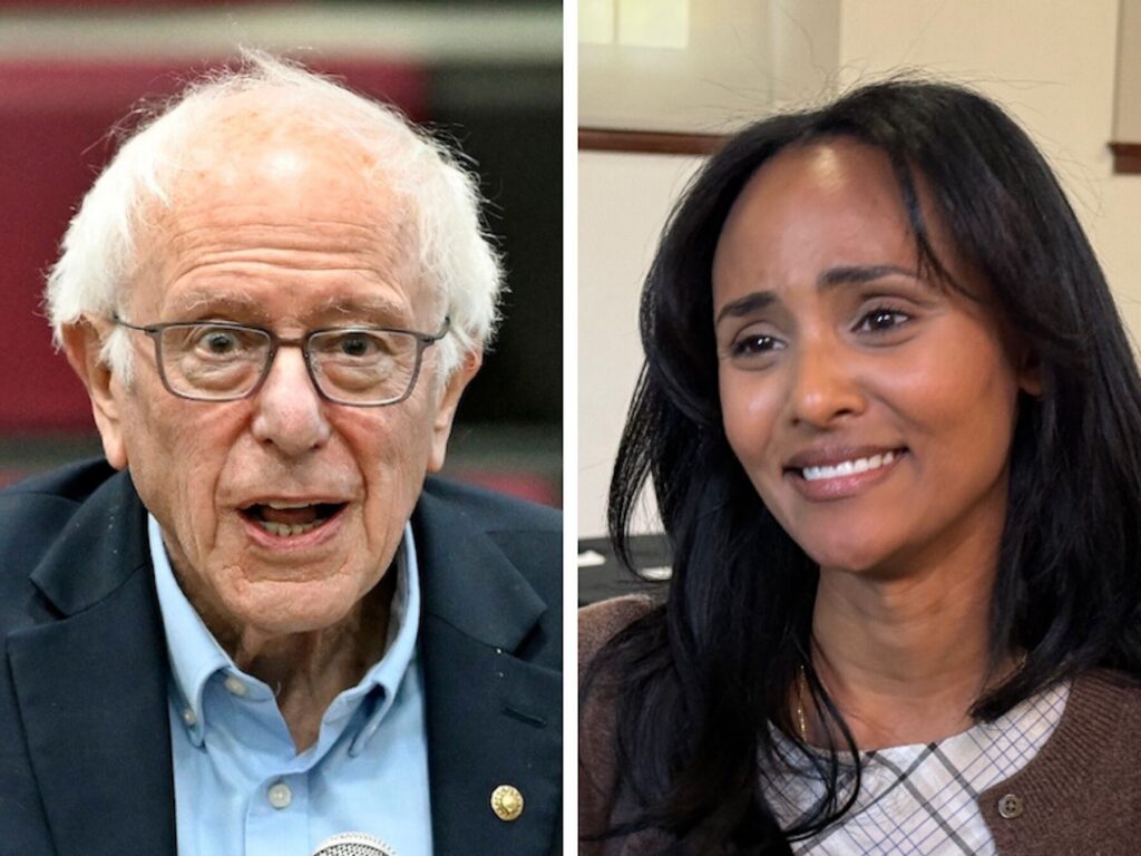
Bernie Sanders endorses DeGette challenger Melat Kiros in Colorado’s 1st CD Democratic primary
Ernest Luning
ernest.luning@coloradopolitics.com
Updated 6 days ago
U.S. Sen. Bernie Sanders on Friday endorsed congressional candidate Melat Kiros, one of two Democrats challenging 15-term U.S. Rep. Diana DeGette in Colorado’s June primary. Sanders, a Vermont independent who caucuses with the Democrats, called the 29-year-old Kiros “exactly the...
Democratic ballots outpace Republicans’ as Colorado’s primary vote starts to trickle in
Ernest Luning
ernest.luning@coloradopolitics.com
Updated 6 days ago
With less than two weeks left before ballots are due in Colorado’s primary election, election officials have logged in ballots from just under 6% of the state’s 4 million active, registered voters, the Colorado Secretary of State’s Office said Thursday....

Amid public pressure, Colorado candidates tackle social media regulations for minors
Bethany Johnson
bethany.johnson@denvergazette.com
Updated 4 days ago
Following the accidental overdose of her daughter in 2020, Patti Lujan pursued a lawsuit against Snapchat, the social media platform that, she claimed, connected her daughter with a drug dealer. In a news release announcing the lawsuit, Lujan alleged that...
PREV
PREVIOUS

Audit finds 'weak oversight’ of Denver's college fund; millions of dollars unallocated
A Denver program that funds college scholarships for low-income students accumulated millions of dollars in revenue but only distributed less than half of those funds in the last five years, even as its administrative expense stood at nearly $2 million, a city audit said. City auditors, who looked into the voter-approved college scholarship fund, […]

Colorado Springs educators, health officials share concerns during fentanyl roundtable meeting
The growing fentanyl crisis in Colorado and across the U.S. is a multifaceted problem, and it will take a multipronged approach to effectively combat it. That was the consensus of the dozens of educators, administrators, care providers and public health officials who attended a roundtable discussion at the school District 11 administration building on Tuesday. […]