

More people, more cars: As El Paso County grows, planners grapple with traffic ‘pain points’

Curtis Hill remembers a time before the unavoidable stop-and-go nature of traffic across Colorado Springs and El Paso County when it felt like getting around town was easier – and quicker.
“Everywhere in Colorado Springs has traffic (now),” he said one recent Friday afternoon at his home near Airport Road and Powers Boulevard, where he’s lived since 2014.
He should know. He estimates driving about 50 miles a day across the city, including taking his grandchildren to and from schools they attend all over town.
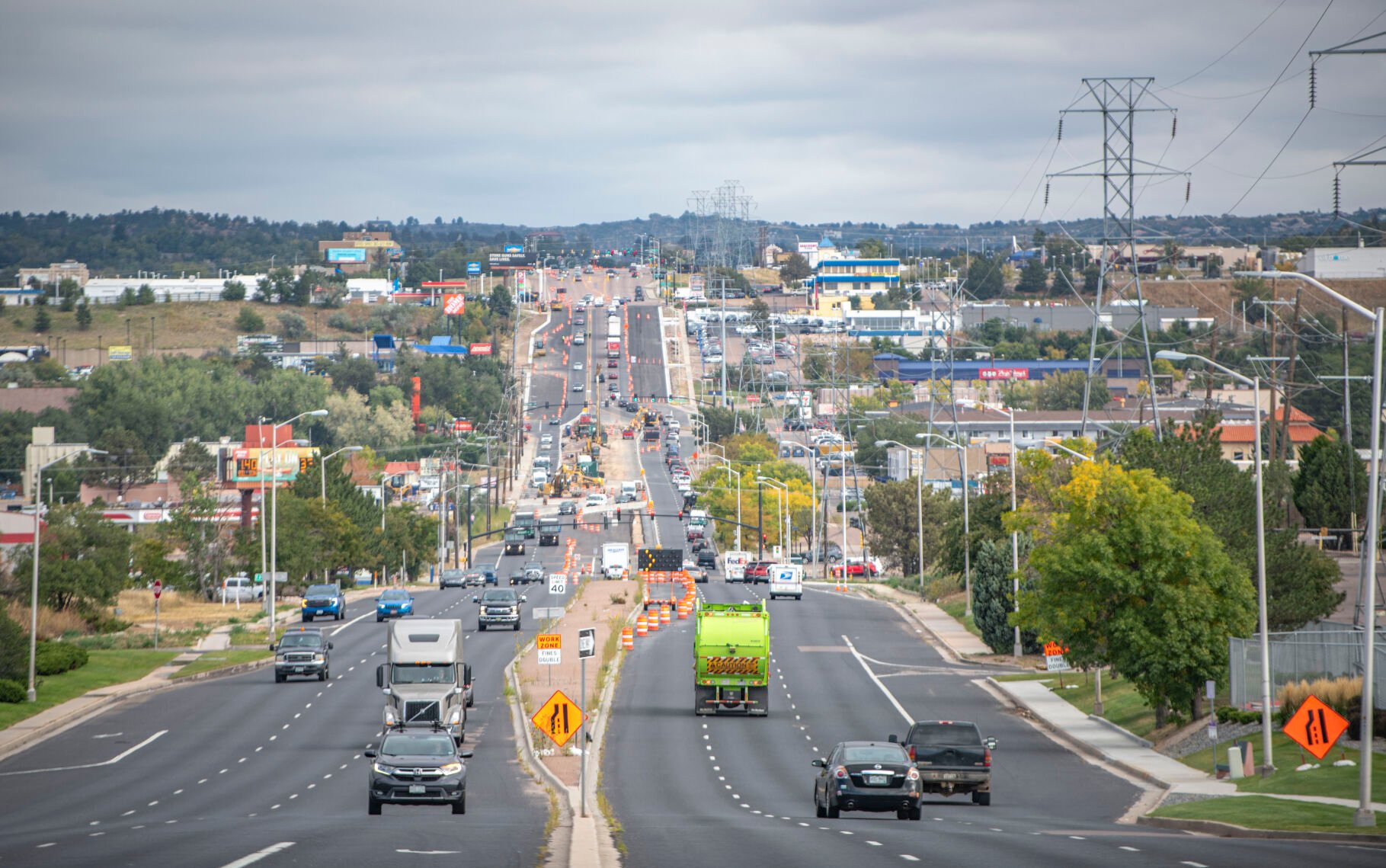
By 3 p.m. that Friday, traffic was flowing but beginning to back up along Powers, the intermittent crowding stretching along the corridor up to East Woodmen Road some 9 miles north.
Traffic congestion has in recent years become a familiar inconvenience for travelers, residents across El Paso County said. It’s a symptom they expect comes with the territory of the county’s rapid growth. They worry it could worsen as development continues booming, particularly on Colorado Springs’ eastern and northern edges where there is space for more urban and suburban sprawl.
Examining growth in Colorado Springs | Full Coverage
“Traffic will get worse. People are going to keep coming,” said Hill, who first lived in Colorado Springs from 1986 to 1996 before relocating then returning to the city nine years ago.
Who Are We? What the population numbers for El Paso County and Colorado Springs show
El Paso County’s population has nearly doubled since 1990, data from the Colorado Demography Office show, growing from about 397,000 residents in 1990 to more than 730,000 in 2020. Officials estimate just under 757,000 people currently reside in the county, according to figures included in the 2023 budget. By 2050, more than 1 million people are expected to live in El Paso County.
In Colorado Springs, officials anticipate more than 502,000 people will live in the city next year, figures included in a draft 2024 city spending plan show.
As growth occurs, many commuters are familiar with increased congestion or reduced safety on thoroughfares like Platte Avenue, Marksheffel Road, South Academy Boulevard, Woodmen Road at Black Forest Road and Powers Boulevard.
Officials are actively trying to address current issues, and plan for those coming.
Planning for growth
A number of regularly updated long- and short-term regional, county and city transportation plans help local planners proactively identify where growth is likely to happen and define ensuing transportation needs, they said.
Revisiting those plans every five to seven years, including the city’s 20-year transportation plan known as ConnectCOS or the county’s 20- to 25-year Major Transportation Corridor Plan, allows planners to reassess and adjust the wider vision for the local transportation network.
Residents in Colorado Springs’ outlying areas watch as growth creeps closer
The city and county use traffic data and public feedback to inform those plans.
“… Public input is huge because there’s a lot of things out there that we don’t see, including traffic congestion, traffic behavior, drivers’ behavior, intersection issues (and) condition issues with our roads,” county engineer Joshua Palmer said.
Developers also play a role in the transportation network, designing early road systems that accommodate the broader grid.
“Hopefully we do a good enough job with planning and working with the development community that, as they are developing and improving combined developed areas, they are setting the stage for and are helping us build something that requires less maintenance and less preservation,” Palmer said.
Residents in Colorado Springs’ outlying areas watch as growth creeps closer
Colorado Springs traffic engineer Todd Frisbie said evaluating short-term needs helps define 10-year projects that could be funded by the Pikes Peak Rural Transportation Authority’s 1-cent sales tax that funds regional road projects.
Meanwhile, transportation officials maintain roads and address emergent road-related demands like potholes or aging infrastructure, “necessary and critical” actions to support future smart growth, Palmer said.
The overarching goal is always to provide an efficient transportation system, Frisbie added, with “acceptable” levels of delay and a variety of transportation choices for commuters.
But sometimes the goal isn’t that simple because of timing, funding constraints and land uses.
In some cases, development happens quicker than road improvements can occur, which can cause pockets of congestion, Frisbie said.
5 growth hotspots around Colorado Springs: A closer look
Expanding roads in the more urbanized, built-out areas of Colorado Springs can require tens of millions of dollars and can significantly impact nearby neighborhoods, so the city also focuses on enhancing mass transit and improving walkability in those areas.
And building new, bigger roads can initially relieve congestion but can also promote more traffic, he said, a concept known as “induced demand.” It suggests more travelers will use more roads if they’re available.
“… Our transportation planning is intended to make traffic ‘better’ … by way of achieving and maintaining an acceptable level of delay today and into the future when fiscally feasible, and better in the sense of providing transportation choices,” Frisbie said.
Pain points
Platte Avenue corridor. A memorial at East Platte Avenue and North Arcadia Street still standing weeks later honors the memory of Spc. Randy Castro, 22, a Fort Carson soldier who was killed in a car crash on Platte in the early morning hours of Sept. 17.
Two other Fort Carson soldiers were injured in the crash, including 23-year-old Cpl. Jermell Johnkin, the driver. Colorado Springs police said Johnkin may have been impaired while driving and speed may have also been a factor. He was arrested for his role in the crash.
Marea Janae and Felicia Marshall, who live on Platte near the crash site, said speeding vehicles and crashes are common along this stretch of road. Many vehicles traveling east on Platte hit a somewhat hidden drainage ditch, and combined with speed that can prove “treacherous,” they said.
“I don’t think signs will fix it,” Marshall said. “We need a way to slow traffic down.”
Janae said the drainage ditch “absolutely” must be addressed. “I love living downtown and being able to bike everywhere, but I hate living on Platte Avenue because of that traffic,” she said.
Platte is one of a limited number of east-west thoroughfares across the city, one that traffic planners have identified as likely to see increased demand for various modes of travel as buildout continues east of Powers Boulevard on the city’s east side.
The corridor could get a major redesign in the coming years. The city is studying Platte between Interstate 25 and Powers, and a draft report is now available online for public comment through Oct. 13.
The document recommends several possible improvements along the thoroughfare based on unique neighborhoods.
Residents have pushed back on a controversial proposal that would transform Platte into an eastbound one-way corridor from Wahsatch Avenue to its intersection with Boulder Street. The project webpage states while this idea is listed in the plan as a “potential solution for consideration,” it isn’t recommended based on public feedback.
Possible improvements include shared use paths, east-to-west bicycle network connections along Bijou Street and enhancing existing transit stations and stops as needed. Additionally, the downtown portion of Platte could see fewer travel lanes, with more lanes possibly going in farther east from Academy Boulevard to Powers.
Curbing population growth is hard to do | Cronin and Loevy
Marksheffel Road. Getting into and out of Banning Lewis Ranch, the 24,000-acre (38-square-mile) development on the city’s eastern edge, is becoming tougher during the peak afternoon hours, neighbors said.
The community east of Marksheffel Road, largely between East Woodmen Road and Dublin Boulevard, is expected to absorb most of the growth in town in the coming decades. But as homes have built out and more businesses have developed nearby, the few ingress and egress points in Banning Lewis Ranch plus limited commercial access points have added extra minutes and frustration to residents’ commutes, they said.
“I would take a back road just to avoid Marksheffel and get into our neighborhood,” resident Kim Benson said. “From 4 to 6 p.m., it’s bogged down with traffic and it’s hard to get in and out of Banning Lewis.”
She’s lived in the community for two years and says the traffic has gotten worse in that short time.
That’s an example of timing between developers and the city being off, Frisbie said.
“New development gets built but the roads lag behind. The city and its funding can’t keep up with development as it happens,” he said.
Colorado Springs officials anticipate developers will eventually connect Banning Lewis Parkway to Woodmen. This would push a lot of traffic to Woodmen, helping relieve it at Dublin and Marksheffel, Frisbie said. Improvements would also include extending Barnes Road and Stetson Hills Boulevard east.
“In a sense it will start to spread it out a little bit more so not one roadway, not one intersection, is taking the brunt of that development,” he said.
Who Are We? What the population numbers for El Paso County and Colorado Springs show
The city aims to enhance safety and reduce congestion along Marksheffel between North Carefree Circle and Dublin by adding an additional lane in each direction and turn lanes at intersections. When complete, Marksheffel Road will be two lanes in each direction with a center median, as well as on-street bike lanes or wide shoulders, improved drainage, and new sidewalks and paths.
Work began this summer on the first phase of the multi-year project.
South Academy Boulevard. Officials are fixing aging and deteriorating parts of South Academy Boulevard, the first major repairs to the critical transportation corridor that goes through Colorado Springs’ southeast side since it opened more than five decades ago in 1969.
George Norris was stationed with the Air Force in Colorado Springs from 1979 to 1982 and returned in 1986. From the porch step of his home near South Academy and Airport Road, where he’s lived ever since, he recalled when the roadway was known as Highway 83 and when it lost its main highway status to Powers Boulevard.
“It used to be called ‘Academy Speedway’ (by residents), because everybody sped,” Norris said.
Decades ago, the road used to be “rough” to drive on because of speedy and often dangerous driver behavior. Now, crumbling pavement and other maladies have put a new meaning to the phrase, he said.
Crews are addressing crumbling pavement, battered curb and gutter and inefficient drainage on about 18 lane miles along the road from Bijou Street to Jet Wing Drive.
When it is finished, this portion of South Academy will have a smoother driving surface for the approximately 50,000 vehicles that traverse it daily, ponding water will be significantly reduced or eliminated, and it will be easier for pedestrians and bicyclists to travel, the project website states.
Though construction has tapered off the South Academy lanes directly by his home, Norris said it’s about time.
“If they’re repaving everything, it’s necessary,” Norris said.
Woodmen Road at Black Forest Road. Over the past year and a half, work to widen Black Forest Road to two lanes in each direction from Woodmen Road to Research Parkway has made significant progress, and could wrap up late next year.
Various improvements will include new turn lanes at Black Forest and Cowpoke roads to improve traffic flow, two new southbound and northbound bridges over Cottonwood Creek, a 6-foot-wide sidewalk on the east side of Black Forest Road and a 10-foot-wide sidewalk on the west side, along with new 6-foot shoulders that will provide space for cyclists and for vehicles to pull off.
Once complete, the improvements could ease slow moving traffic in the area, officials have said.
But some residents are worried the timeline is already behind.
“… Road planning is ridiculously reactionary in Colorado Springs, with the added caveat that it’s five years behind,” Reddit user Halloween141 said in a recent post on the social media website where The Gazette solicited public feedback on problematic traffic corridors around the city.
The areas of Marksheffel at Woodmen and Black Forest, they said, are “growing so quickly that by the time these areas are ‘finished’ with road construction, it’ll be time to rewiden, repave, and here we go with the headaches again.”
A cowboy’s tale of growth in Colorado Springs
Powers Boulevard. Stretching 20 miles across eastern El Paso County, Powers Boulevard has become the “best opportunity” to build a circular network of local roads, a loop, following recent explosive growth, leaders have previously said.
Long term, the Colorado Department of Transportation envisions Powers as an expressway running from Interstate 25 to the Colorado Springs Airport. A broad state plan includes improving interchanges along the roadway – building overpasses – because of growth.
Last September, state and regional leaders opened a new overpass on Powers at Research Parkway. The state plans to build another at Airport Road, an imperative access point for Peterson Space Force Base’s west gate. Construction on that interchange could start late this year or in 2024.
Traffic along Powers is typically heavy, said Gladys Meza, who lives off Airport Road.
“Around 5 or 6 p.m. it backs up, and it’s made worse with (car) accidents,” she said. “… I know a lot of people, instead of using Powers, will take Marksheffel to get around.”
An agreement between Colorado Springs, El Paso County, the Pikes Peak Rural Transportation Authority and the Copper Ridge Metropolitan District could accelerate the completion of extending Powers north from Colorado 83, where it now ends, to Voyager Parkway. It would be the last link in a new loop of major roadways around Colorado Springs.
Palmer said officials are also in the early planning stages of connecting Powers to I-25 at El Paso County’s southern end, but have no answers yet on where exactly the connection will be or which route it will take.

Atop taxes, here’s how much each Colorado resident pays in fees
Marissa Ventrelli
marissa.ventrelli@coloradopolitics.com
Updated 2 hours ago
Each Colorado resident paid nearly $5,000 in state-sanctioned fees last year, according to a report by a policy think tank. The report, which analyzed how fees have affected Colorado’s economy, found that fee revenue has more than tripled since 2008...

Colorado National Guard, Swiss Armed Forces celebrate partnership
Marissa Ventrelli
marissa.ventrelli@coloradopolitics.com
Updated 4 hours ago
Colorado’s National Guard marked a year of partnership with the Swiss Armed Forces at the Governor’s Mansion on Monday. “This anniversary marks one strong year of friendship and collaboration between the State of Colorado and Switzerland,” said Gov. Jared Polis....
Judge allows Trump to refile $15 billion lawsuit against the New York Times
Emily Hallas
emily-hallas@coloradopolitics.com
Updated 4 hours ago
A federal judge declined to dismiss President Donald Trump’s multibillion-dollar lawsuit against the New York Times on Monday, giving him roughly four weeks to amend his case after the outlet moved to toss it on First Amendment grounds. District Judge...

Gov. Polis celebrates Colorado’s first-place education ranking by U.S. News
Marianne Goodland
marianne.goodland@coloradopolitics.com
Updated 2 hours ago
Colorado officials said they have something to celebrate this week, in addition to the state’s sesquicentennial birthday on Saturday. U.S. News & World Report on Tuesday gave Colorado its top ranking for education efforts from pre-K to postsecondary, though it...
Denver detox center did not violate man’s rights with 10-hour hold, 10th Circuit says
Michael Karlik
michael.karlik@coloradopolitics.com
Updated 2 hours ago
The Colorado-based federal appeals court concluded on Tuesday that Denver’s detoxification facility did not violate a man’s rights by holding him against his will for 10 hours until his blood alcohol content was projected to reach zero. Unusually, Brian Garrett’s...

Federal judge clarifies ex-GOP treasurer candidate’s burden to prove defamation claims
Michael Karlik
michael.karlik@coloradopolitics.com
Updated 2 hours ago
A federal judge clarified last week that businessman and former Republican statewide candidate Brian Watson will need to surmount a higher hurdle in proving his claim that a party guest’s alleged description of him as a “criminal” amounted to defamation....

Denver City Council sends Xcel franchise deal to voters
Deborah Grigsby
deborah.smith@denvergazette.com
Updated 6 hours ago
This November, Denver voters will decide whether to renew the city’s longstanding franchise agreement with Xcel Energy. Members of the Denver City Council approved on Monday sending a proposed 20-year franchise agreement with Xcel that would deliver more than $180...
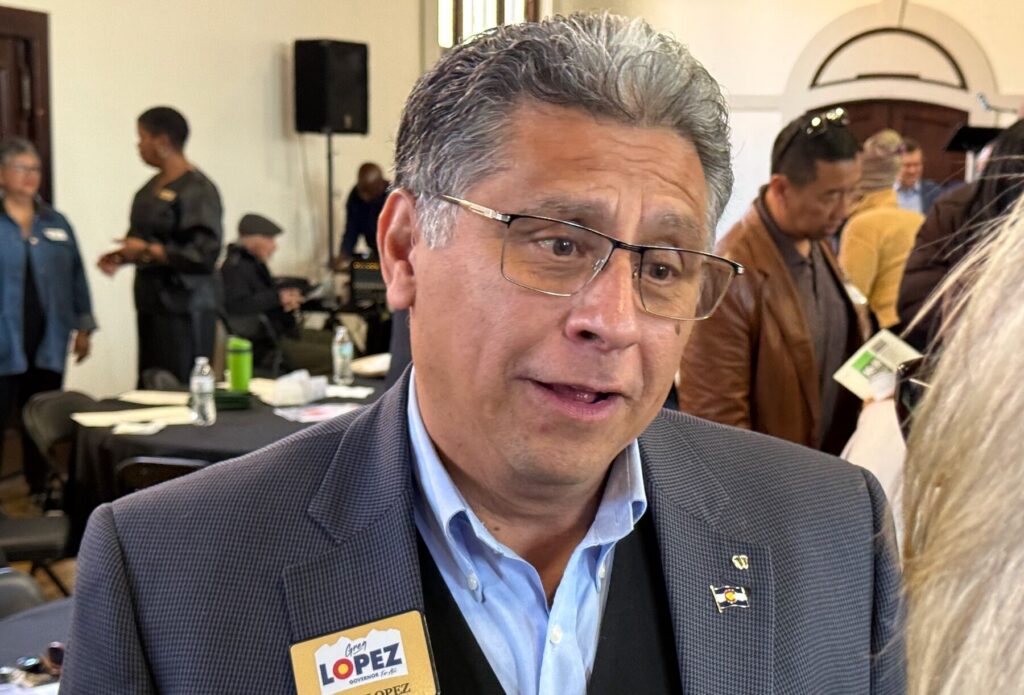
Independent gubernatorial candidate Greg Lopez, a former GOP congressman, qualifies for Colorado ballot
Ernest Luning
ernest.luning@coloradopolitics.com
Updated 2 hours ago
Unaffiliated gubernatorial candidate Greg Lopez, a former Republican congressman from Elizabeth who left the GOP to run as an independent, has qualified for the ballot by submitting enough petition signatures, the Colorado Secretary of State’s Office said Tuesday. He’ll face...
At Colorado’s 150th anniversary, leaders offer birthday wishes
Thelma Grimes
thelma.grimes@coloradopolitics.com
Updated 8 hours ago
As Colorado’s 150th anniversary approaches, leaders from across the state reflect on the spirit that binds the plains, mountains, Western Slope and Front Range — a shared commitment, they underscored, to opportunity, community, stewardship and personal freedom. Their tributes highlight...

Fauci’s private COVID-19 diaries: Six takeaways on fame, prize money and the lab leak debate
The Washington Examiner
the-washington-examiner@coloradopolitics.com
Updated 11 hours ago
Anthony Fauci’s private writings from 2020 and beyond portray a public health official who was fixated on his growing celebrity while privately grappling with a pandemic response he believed was chaotic, leaderless and consumed by internal rivalries. The writings of...
PREV
PREVIOUS

Woodland Park man whose mom may be among Penrose bodies blames 'monsters' allowed by lack of government oversight
His instincts tried to warn him that something wasn’t right about Return to Nature, but Jesse Elliott’s grief had been so loud. The Woodland Park man had just lost his 76-year-old mom, Yong Anderson, on June 2. He was in a fog and just trying to do the things one must after death leaves a […]

Littleton Democrat David Ortiz will not seek reelection to Colorado House
State Rep. David Ortiz, a Littleton Democrat, announced Wednesday he will not seek a third term in Colorado House District 38. In a statement issued by the House Majority Project, Ortiz said: “Second only to serving in our armed forces and serving with some of the most amazing humans this country has to offer, serving […]