

Census data reveals population adjustments needed in draft maps

Colorado’s redistricting commissioners decided earlier this year to use incomplete and out-of-date data to draw the preliminary draft maps that are being toured around the state for public input.
The commissioners knew at the time that their maps would end up needing adjustments, because the official data was bound to be different in some parts of the state.
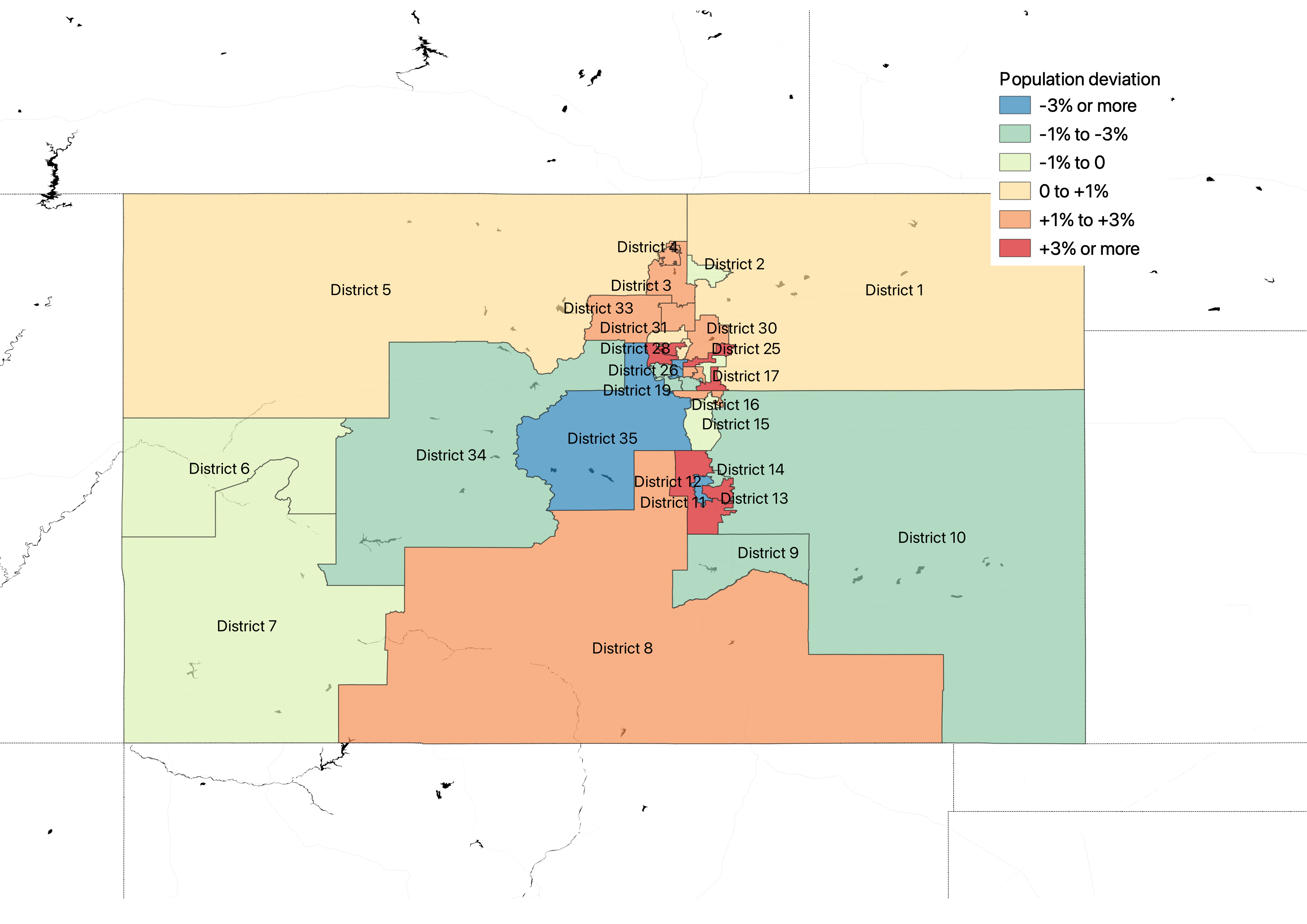
With the release of the official census data, it’s possible to see exactly where the commissions’ maps have districts with too many people or too few people.
The preliminary draft congressional map has smaller deviations than the preliminary draft state House and Senate district maps, but congressional districts are required to be equal, down to the person. They can deviate by only one person where necessary.

The preliminary draft legislative maps have bigger deviations, but a small amount of deviation away from the ideal population is legally acceptable, according to U.S. Supreme Court rulings, particularly if the deviations help achieve Voting Rights Act protections for minority voters.
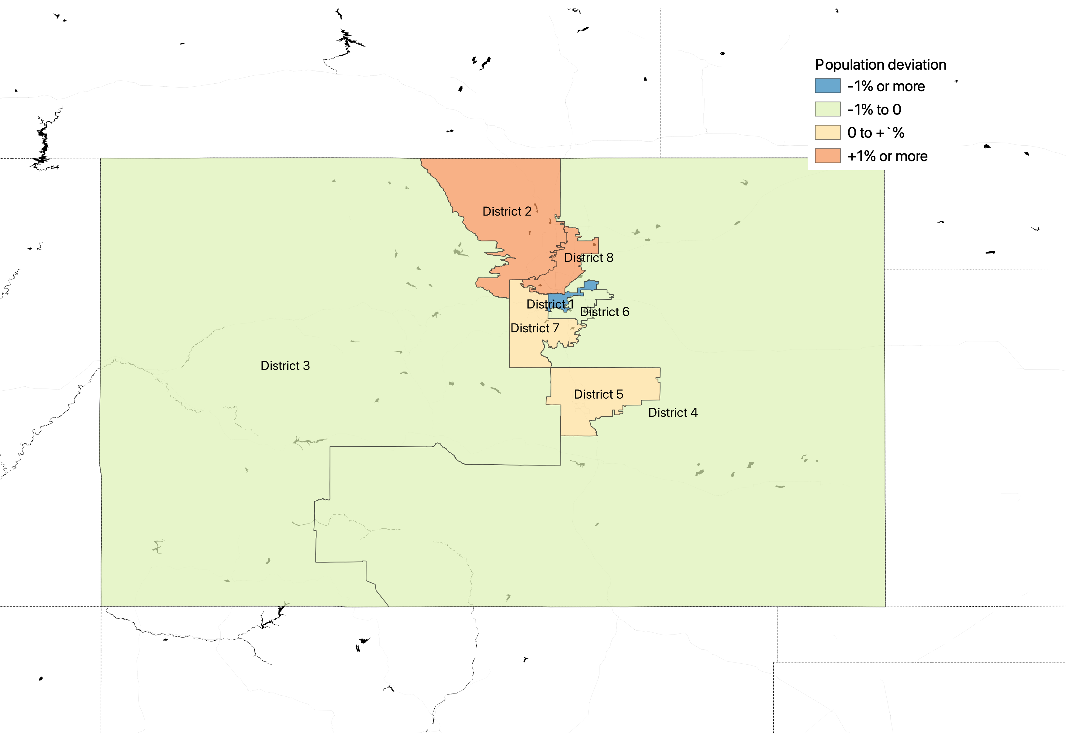
In the coming weeks, the state’s independent redistricting commissioners will adjust their preliminary draft maps, based on public input they’ve received throughout the summer.
They’re expected to finish in early October.

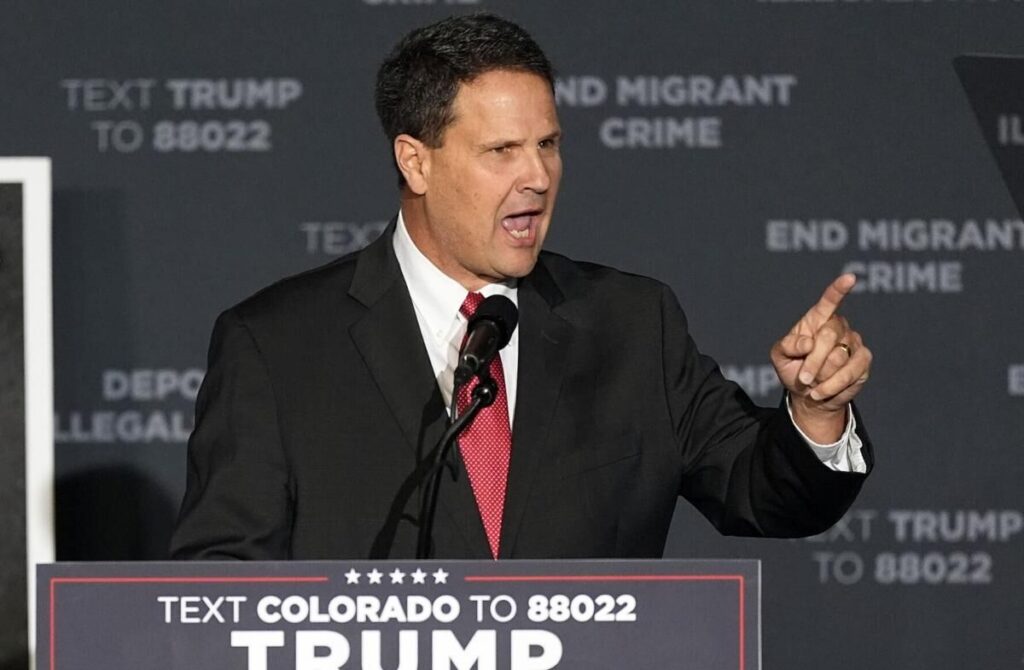
Rural frustration, parental rights shape Scott Bottoms’ pitch ahead of Colorado’s gubernatorial primaries
Thelma Grimes
thelma.grimes@coloradopolitics.com
Updated 6 hours ago
With just weeks before Colorado’s June primary, Republican gubernatorial candidate state Rep. Scott Bottoms is spending nearly all his time on the road — literally crisscrossing the Western Slope and Eastern Plains — in a final push to connect with...
Registered voters on the eve of the 2026 primaries | Cronin & Loevy
Tom Cronin Bob Loevy
tom-cronin-bob-loevy@coloradopolitics.com
Updated 3 days ago
The Colorado Secretary of State’s Office has published the latest voter registration figures for the state and its counties as of June. Colorado ranks among the highest states for independent, or unaffiliated, voters. Only Alaska and Massachusetts have more. New Hampshire, New Jersey, Maine and Oregon also rank highly. So here...
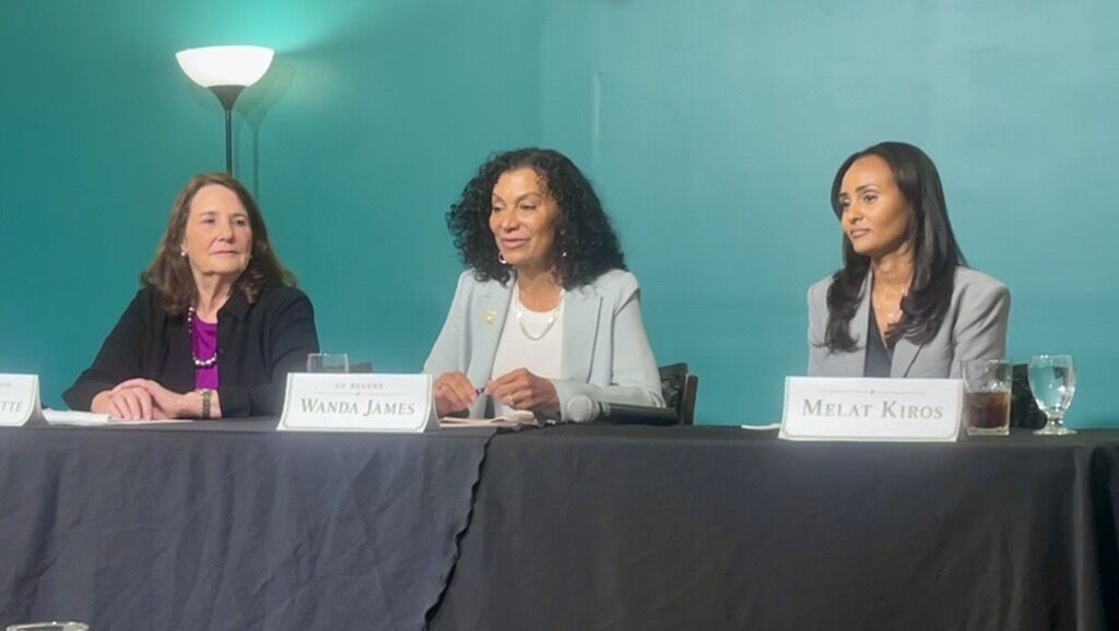
Democratic candidates DeGette, Kiros and James clash in CD1 forum
Marissa Ventrelli
marissa.ventrelli@coloradopolitics.com
Updated 1 day ago
The three Democratic candidates for Colorado’s 1st Congressional District clashed on Friday night over a host of issues, even as they expressed frustration with their party. The candidates — U.S. Rep. Diana DeGette, doctoral student Melat Kiros and university regent...
Rep. Jeff Crank thinks Democrats are too focused on Trump, not enough on Colorado Springs | Vince Bzdek
Vince Bzdek
vince.bzdek@gazette.com
Updated 2 days ago
For U.S. Rep. Jeff Crank, who’s unopposed in the Republican primary for the 5th Congressional District but the main target of both candidates in the lively Democratic primary, the big question in the midterms is not who will stand up...

Bernie Sanders endorses DeGette challenger Melat Kiros in Colorado’s 1st CD Democratic primary
Ernest Luning
ernest.luning@coloradopolitics.com
Updated 4 days ago
U.S. Sen. Bernie Sanders on Friday endorsed congressional candidate Melat Kiros, one of two Democrats challenging 15-term U.S. Rep. Diana DeGette in Colorado’s June primary. Sanders, a Vermont independent who caucuses with the Democrats, called the 29-year-old Kiros “exactly the...
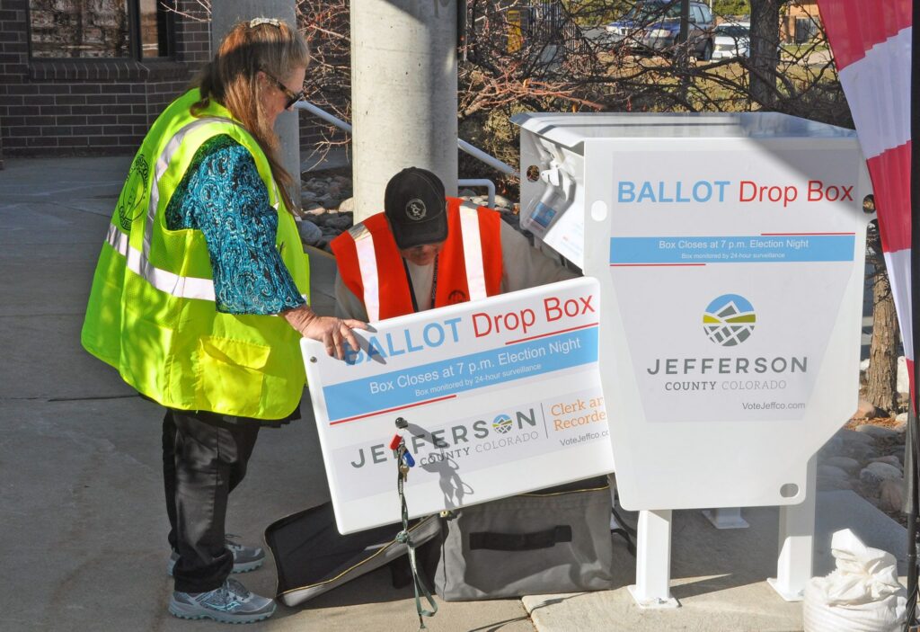
Democratic ballots outpace Republicans’ as Colorado’s primary vote starts to trickle in
Ernest Luning
ernest.luning@coloradopolitics.com
Updated 4 days ago
With less than two weeks left before ballots are due in Colorado’s primary election, election officials have logged in ballots from just under 6% of the state’s 4 million active, registered voters, the Colorado Secretary of State’s Office said Thursday....

Amid public pressure, Colorado candidates tackle social media regulations for minors
Bethany Johnson
bethany.johnson@denvergazette.com
Updated 2 days ago
Following the accidental overdose of her daughter in 2020, Patti Lujan pursued a lawsuit against Snapchat, the social media platform that, she claimed, connected her daughter with a drug dealer. In a news release announcing the lawsuit, Lujan alleged that...
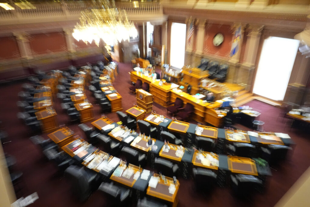
Colorado state Senate: Meet the primary election candidates
Marianne Goodland
marianne.goodland@coloradopolitics.com
Updated 6 days ago
Colorado’s June 30 primary features a slate of state Senate contests, with several incumbents stepping aside and competitive fields emerging in both parties. These are some of the races to watch as voters begin to submit ballots. Senate District 3:...

Hickenlooper raises $900K since April, heads into primary with almost $3 million on hand
Ernest Luning
ernest.luning@coloradopolitics.com
Updated 6 days ago
U.S. Sen. John Hickenlooper raised just over $900,000 for his reelection bid in the 10-week pre-primary reporting period, the Colorado Democrat’s campaign said Wednesday. The campaign finished the period with almost $3 million in the bank, with more than 80%...
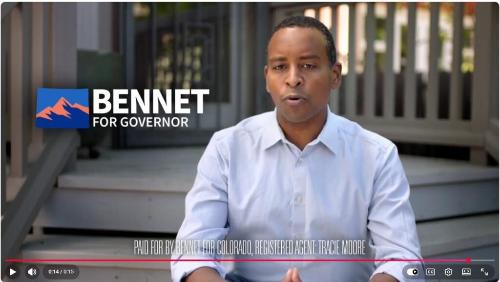
Bennet’s gubernatorial ads say U.S. Senate committee paid for them
Marianne Goodland
marianne.goodland@coloradopolitics.com
Updated 6 days ago
Update: as of Wednesday morning, at least one of the ads, featuring Colorado’s Democratic congressional delegation, has been changed to include the disclaimer “paid for by Bennet for Governor.” A series of TV commercials for U.S. Sen. Michael Bennet’s gubernatorial...
PREV
PREVIOUS

A LOOK BACK | Tancredo affirms rumors he may vacate office
Forty Years Ago This Week: Several loud and persistent rumors surrounding the vacated position for the Region 8 director of the Department of Education was enough to warrant a response from one of the supposed candidates for the role, state Rep. Tom Tancredo, R-Arvada. “I know that my name has been placed before the Secretary […]
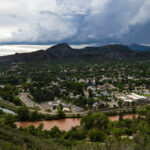
RIVER TOWN: DURANGO | The Animas, a river in recovery after mining pollution, faces ash flows, drought
ABOUT THE SERIES In the arid West, water means life. Turn on your tap, and you’re part of the Colorado circulatory system. The towns born along Colorado’s most iconic waterways – the Colorado, the Big Thompson and the Arkansas lead a list of 158 named rivers – live the same way yet differently along the banks. […]