

What you need to know about the legislative maps
According to the Colorado Independent Redistricting Commission, these are the requirements for drawing the maps that outline the borders for each state House and Senate district:
- Have equal population, as required by the U.S. Constitution, with a population deviation of no more than 5 percent between the most populous and the least populous district in each chamber;
- Be composed of contiguous geographic areas;
- Comply with the federal Voting Rights Act of 1965, as amended;
- Preserve whole communities of interest and whole political subdivisions, such as counties, cities, and towns; however, a division of a county, city, city and county, or town is permitted where a community of interest’s legislative issues are more essential to the fair and effective representation of residents of the district. When the commission divides a county, city, city and county, or town, it shall minimize the number of divisions of that county, city, city and county, or town;
- Be as compact as is reasonably possible; and thereafter;
- Maximize the number of politically competitive districts.
Districts cannot be drawn for the purpose of:
- Protecting incumbents in or declared candidates for the Colorado General Assembly or any political party; or
- Denying or abridging the right of any citizen to vote on account of that person’s race or membership in a language minority group, including diluting the impact of that racial or language minority group’s electoral influence.
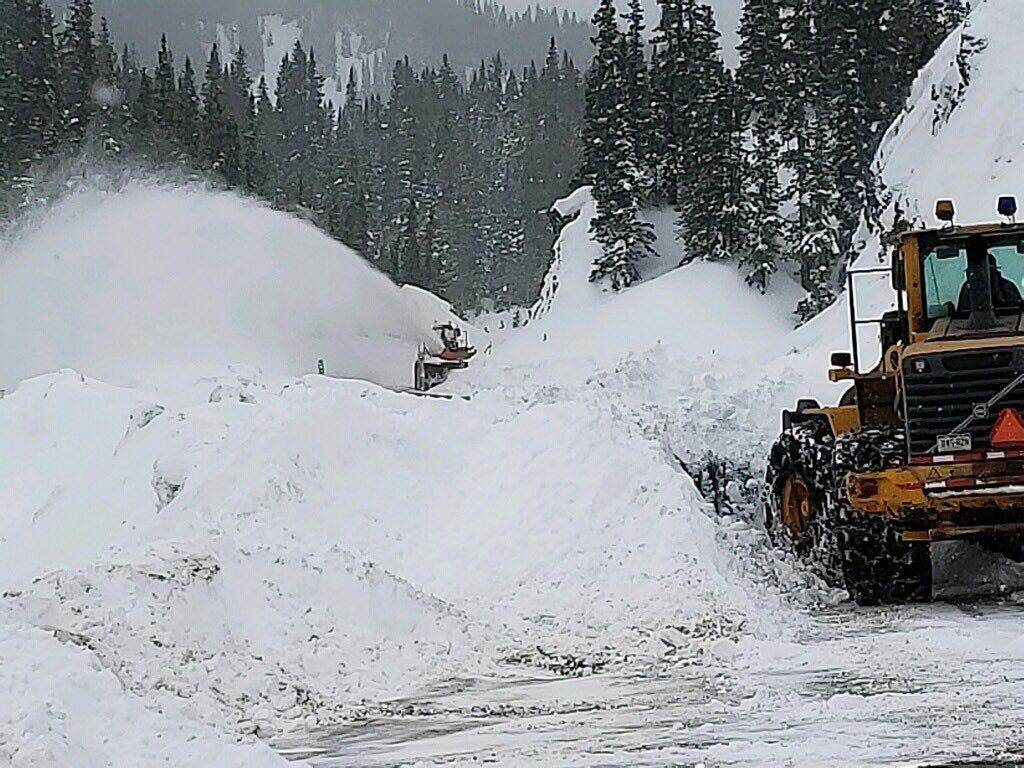
Colorado Reps. Hurd and Neguse join forces to modernize federal snow-forecasting program
Marianne Goodland
marianne.goodland@coloradopolitics.com
Updated 6 hours ago
A federal snow-forecasting program, to be updated under a bill from Republican U.S. Rep. Jeff Hurd, won approval in the House on Wednesday. HR 3857, which amends the Snowpack Water Supply Forecasting Reauthorization Act, is Hurd’s second bill to pass...
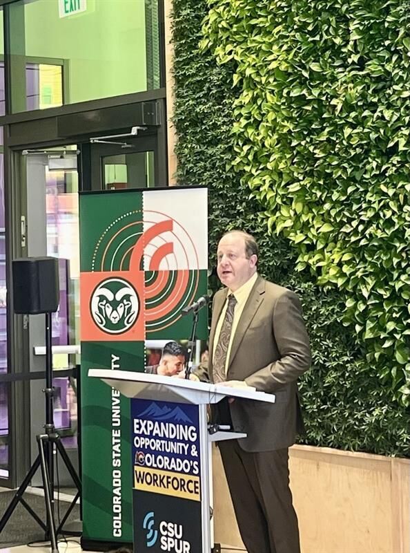
Colorado aims to close talent gap with new workforce development agency, initiatives
Marissa Ventrelli
marissa.ventrelli@coloradopolitics.com
Updated 6 hours ago
Colorado’s education leaders and legislators are planning changes to the state’s workforce development programs – including the creation of a new state agency – to help more students earn college degrees, certifications and apprenticeships. Gov. Jared Polis, House Speaker Julie...

Colorado legislators review wolf program as funding challenges persist
Marianne Goodland
marianne.goodland@coloradopolitics.com
Updated 5 hours ago
Wolves took center stage during a Tuesday review by Colorado legislators of the budget proposal from the Department of Natural Resources, which includes the division that manages the reintroduction program. The Joint Budget Committee reviewed the budget proposal for 2026-27...
Palmer Lake to discuss Buc-ee’s, recall elections Thursday
Savannah Eller
savannah-eller@coloradopolitics.com
Updated 6 hours ago
The newly-whole Palmer Lake Board of Trustees will have an opportunity Thursday to discuss the setting for two issues going to town voters in the new year. The first is when and how to field a ballot question on the...

Colorado Parks and Wildlife Commissioner Murphy Robinson resigns
Marianne Goodland
marianne.goodland@coloradopolitics.com
Updated 1 day ago
Murphy Robinson, who has served on the Colorado Parks and Wildlife Commission for just over a year, announced his resignation on Wednesday. In a statement, Gov. Jared Polis thanked Robinson, saying he is “incredibly grateful for Murphy’s service to the...
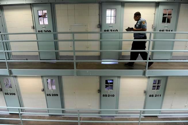
DOJ launches investigation into Colorado prison, youth facility conditions
Cleo Westin
cleo-westin@coloradopolitics.com
Updated 13 hours ago
The U.S. Department of Justice has opened an investigation into possible constitutional violations of Colorado prisoners through inadequate treatment and transgender housing policy, according to federal authorities. The department’s letter of notice to Gov. Jared Polis on Monday identified housing...

Colorado Supreme Court’s opinion output drops by two-thirds amid justice’s absence
Michael Karlik
michael.karlik@coloradopolitics.com
Updated 1 day ago
The Colorado Supreme Court has released significantly fewer new opinions in recent months compared to the previous two years, even as the judicial branch insisted that a member’s open-ended absence is not causing delays. Justice Melissa Hart has been on...
Colorado’s universal preschool enrollment begins for upcoming school year
Marissa Ventrelli
marissa.ventrelli@coloradopolitics.com
Updated 1 day ago
Enrollment is now open for Colorado’s universal preschool program, which provides up to 15 hours of free education for four-year-old children across the state. The $344 million program has served nearly 90,000 children since its creation in 2023, the Governor’s...

Divided 10th Circuit rules bank customer must arbitrate discrimination-related claims
Michael Karlik
michael.karlik@coloradopolitics.com
Updated 1 day ago
The Denver-based federal appeals court ruled on Monday that a mandatory arbitration clause in the fine print of a customer’s bank account agreement prohibited her from pursuing claims of racial discrimination in court. Jeanetta Vaughn filed suit against JPMorgan Chase...

Colorado’s federal trial court denies admission to lawyer owing tens of thousands in dues, penalties
Michael Karlik
michael.karlik@coloradopolitics.com
Updated 5 hours ago
Colorado’s U.S. District Court declined last month to allow an attorney to practice before the court due to his failure to pay enrollment fees and penalties to another state’s bar association for years. The federal trial court requires attorneys to...
PREV
PREVIOUS

Politicos react to preliminary legislative redistricting maps
State political leaders and observers weighed in Tuesday on the preliminary maps drawn for the state House and Senate, acknowledging that the maps are certain to change between now and when the commission finalizes them later in the year. Colorado Republican Party Chairwoman Kristi Burton Brown stressed that these are the initial maps and that […]

Polis signs ag stimulus bills, legislation on education
Gov. Jared Polis on Tuesday signed into law a pair of state stimulus bills on agriculture and a package of education legislation during stops in Denver and Aurora. The governor opened the day at the National Western Center in Denver, a facility that is set to receive a boost from the Colorado Recovery Plan funds […]