

New Colorado state park could feature 80-plus miles of trail: Draft plan
A recently released draft master plan paints the picture of a state park under development in southern Colorado.
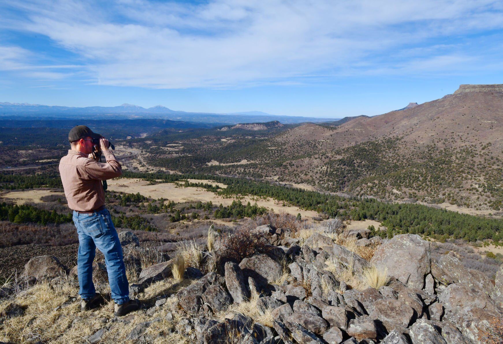
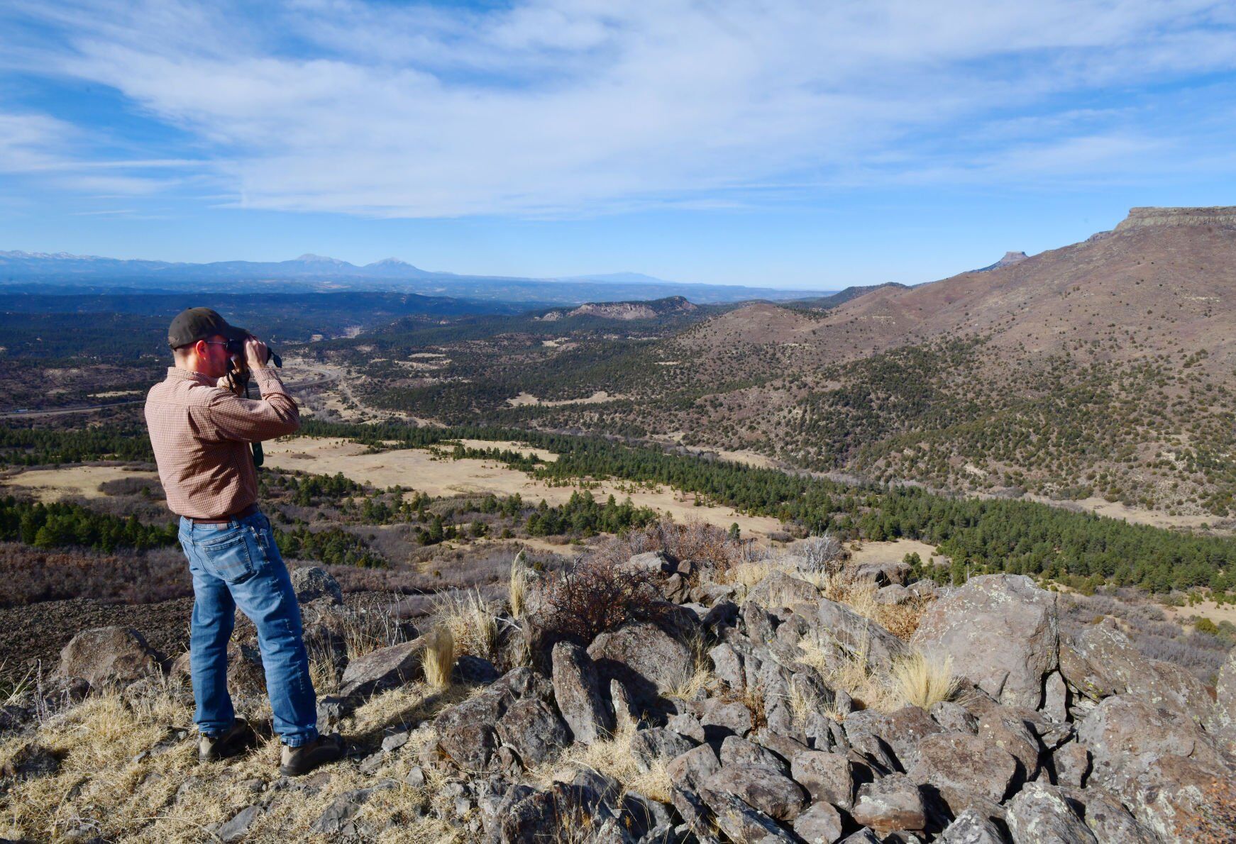
Three years after Fishers Peak State Park was established, a document spanning 188 pages lays out a detailed proposal for the future of the 19,000-plus acres. That includes plans for hikers to finally reach the iconic, flattop mountain over Trinidad that has been held private for generations.
The Trail to the Peak, as it’s mapped, figures to be the premier feature of the three-pronged network outlined in the plan. Ultimately, planners foresee more than 80 miles of trail at Colorado’s second-largest state park.
Tarantu-love: Saving Colorado’s ‘charismatic’ spider
From the Northern Trail System, the summit path is projected to cover 8 miles and 3,200 feet to the peak’s rocky rim. To protect nesting peregrine falcon on the cliffs, the upper portion will be closed from March 15 through July.
Land managers have pinpointed an alternate destination requiring half the distance of the summit: Osita Point, described as “a prominent sub-peak perched in the cool ponderosa pine forests.”
The rest of the Northern Trail System is expected to consist of “lower loops” that “explore rugged ridges and canyons dominated by pinyon-juniper woodlands, providing several short loops (3-8-mile) outings from the trailhead,” according to the plan. Also described is a mountain bike, downhill-only trail dropping 6 miles from the upper woods – “intended to provide a long, flowy experience that explores the landscape, providing a rewarding intermediate-level descent.”
New book features 45 high alpine trail runs in Colorado – we asked for some favorites
The Central Trail System is described next. It’s envisioned to be the launch point from the visitor center, reached from Exit 11 off Interstate 25. This is where the current “First Look” trailhead is situated. The plan depicts several more destinations in the heart of the preserve, including colorful canyons fed by Spring and Clear creeks, a meadow called Big Flats and a high, scenic point called Marion Flat.
Meanwhile, Exit 2 is expected to be the access point for the Southern Trail System, which has “more of a vast and wild character,” according to the plan. Officials see this large portion of the park serving permitted hunters, equestrians and backpackers who could have the long-distance option of crossing the state line to New Mexico’s Sugarite Canyon State Park.
This southern portion typifies the backcountry feel of Fishers Peak State Park. Planners have divided the park into four zones, and 90% of the acreage falls within the “protection” and “natural” categories that call for “limited” recreation.
While Trail to the Peak construction has been underway, officials have said the full realization of the park could take more than a decade.
Trail Talk: State would look very different without Great Outdoors Colorado

Hickenlooper, Crow plan to donate campaign cash from Palantir execs to immigrant rights nonprofits
Ernest Luning
ernest.luning@coloradopolitics.com
Updated 2 hours ago
Two Democratic members of Colorado’s congressional delegation said this week that they plan to donate more than $100,000 received in campaign contributions from current and former employees of Denver-based firm Palantir Technologies to local nonprofits that assist immigrants and support...

Colorado marijuana regulators consider major changes to how labs test for contaminants
Christopher Osher
chris.osher@gazette.com
Updated 1 hour ago
This article was produced for ProPublica’s Local Reporting Network in partnership with The Gazette. Colorado marijuana manufacturers would no longer be allowed to choose which product samples they send for mandatory lab testing under a new regulatory proposal discussed at...
Resolution calling for increased road funding clears Colorado Senate committee
Marissa Ventrelli
marissa.ventrelli@coloradopolitics.com
Updated 18 hours ago
A Republican legislator said he was pleasantly surprised on Wednesday when the state Senate’s transportation panel advanced a resolution brought to him by county commissioners urging the Colorado Department of Transportation to invest more money to fix roads. Road maintenance...

Hail drives up to 54% of homeowners’ insurance premiums in parts of Colorado
Marissa Ventrelli
marissa.ventrelli@coloradopolitics.com
Updated 16 hours ago
Hail is the largest cost driver of homeowners’ insurance spikes in many parts of the state, according to data collected by the Colorado Division of Insurance. The department requested data from 20 homeowners’ insurance carriers to calculate average premiums and...

Denver advances face covering ban for law enforcement
Deborah Grigsby
deborah.smith@denvergazette.com
Updated 16 hours ago
A Denver City Council committee on Wednesday advanced a proposed ordinance banning law enforcement officers, including federal immigration agents, from covering their faces during an arrest or detainment or inside a city facility. The proposed ordinance also establishes a minimum...
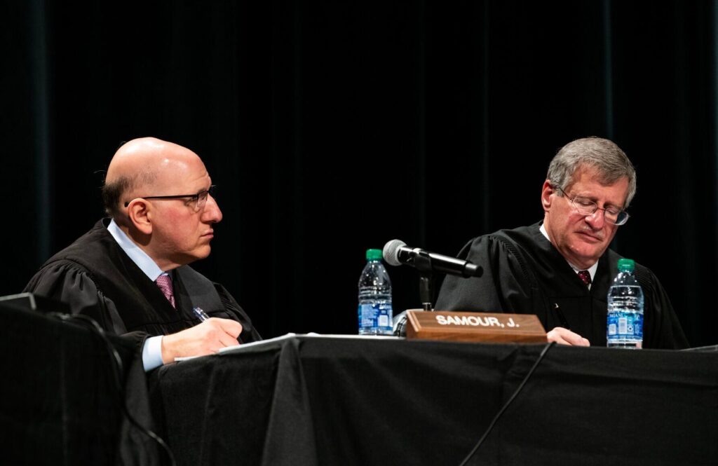
Colorado Supreme Court blocks ‘child-to-parent violence’ testimony in Boulder County case
Michael Karlik
michael.karlik@coloradopolitics.com
Updated 19 hours ago
The Colorado Supreme Court concluded on Friday that a Boulder County judge incorrectly green-lit a psychologist’s expert testimony when the defendant had not laid the necessary groundwork for the evidence. State law requires criminal defendants to provide notice and undergo...
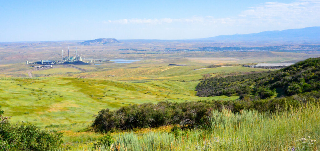
CU Boulder, state launch economic research in coal-transition areas
Scott Weiser
scott.weiser@gazette.com
Updated 49 minutes ago
Communities in northwest Colorado built on coal mining and power plants are losing hundreds of high-paying jobs and a major share of their tax revenue as operations wind down. In a yearlong effort, the University of Colorado Boulder is teaming...
Colorado marijuana regulators consider major changes to how labs test for contaminants
Christopher Osher
chris.osher@gazette.com
Updated 57 minutes ago
This article was produced for ProPublica’s Local Reporting Network in partnership with The Denver Gazette. Sign up for Dispatches to get our stories in your inbox every week. Colorado marijuana manufacturers would no longer be allowed to choose which product...
Colorado justices concerned about retrying defendant after jury signaled acquittal
Michael Karlik
michael.karlik@coloradopolitics.com
Updated 24 minutes ago
Some members of the Colorado Supreme Court appeared uncomfortable on Tuesday with allowing a criminal defendant to stand trial a second time after a Larimer County jury signaled it was deadlocked on some counts but had found him not guilty...

Colorado budget gets clean opinion from Office of the State Auditor
Marissa Ventrelli
marissa.ventrelli@coloradopolitics.com
Updated 18 hours ago
Colorado’s state auditor issued a “clean” opinion on the financial statements prepared by the government and higher education institutions, concluding they met generally accepted accounting principles and the documents were presented fairly. The state’s financial statements reported total assets of...
PREV
PREVIOUS

10th Circuit weighs whether CU medical school's vaccine mandate burdens free exercise of religion
Although a trial judge believed the University of Colorado was not obligated to accommodate more than a dozen medical students and staff whose religious beliefs opposed vaccination for COVID-19, the federal appeals court based in Denver appeared less supportive of the school on Wednesday. A three-judge panel of the U.S. Court of Appeals for the […]

Democrat Jared Polis, Republican Heidi Ganahl come out swinging in first gubernatorial debate
Democratic Gov. Jared Polis and his Republican challenger, Heidi Ganahl, painted contrasting pictures of Colorado during their first debate Wednesday night in Pueblo. Seeking reelection to a second term, Polis described a state on the rebound after “some of the toughest years in our history” – including a series of historic wildfires, a global pandemic […]