

Colorado Springs launches interactive voter turnout map ahead of municipal election
A new interactive online map will allow Colorado Springs residents to track voter turnout leading up to the April 4 nonpartisan municipal election, the city announced Friday.
Colorado Springs officials already preparing for ‘near certain’ mayoral runoff
Users can toggle between tracking turnout percentages by council district or by voter precinct, and data is updated every evening, the city said in the press release.
“This new interactive mapping tool shows our local voter turnout in a simple way and provides even more transparency during the election process,” City Clerk Sarah Johnson said in the release.
The ballot includes a total of 25 candidates vying for mayor – the city’s first in eight years – along with three at-large City Council seats and an unexpired term for City Council District 3. Only residents living in District 3 will be able to vote in that race.
Voters will also decide whether to extend the Trails, Open Space and Parks (TOPS) tax for another 20 years. The majority of the proceeds of the dedicated 0.1% sales tax, or 1 cent per $10, is split between parks, trails and open space for acquisition, stewardship and maintenance.
Click or tap here to view The Gazette’s comprehensive 2023 Voter Guide.
Click or tap here to access the voter turnout map.
Ballots were mailed on March 10 to all registered, active voters who reside within the corporate boundaries of Colorado Springs. Anyone who did not receive a ballot is encouraged to contact the city clerk’s office at 719-385-5901 or visit ColoradoSprings.gov/Election.
Colorado Springs residents question possible plagiarism by City Council candidate Michelle Talarico
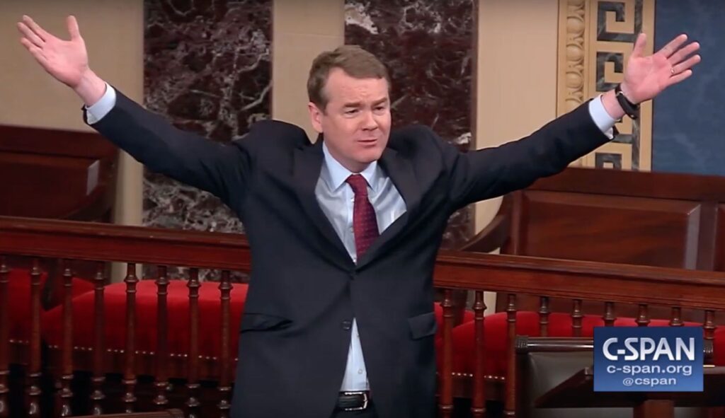
Colorado’s Michael Bennet rode outrage over last government shutdown to presidential bid | TRAIL MIX
Ernest Luning
ernest.luning@coloradopolitics.com
Updated 1 day ago
Only weeks after the longest federal government shutdown in U.S. history ended with congressional Democrats’ demands to restore health care funding previously cut by Republicans left dangling, the high-stakes standoff that dominated political news for 43 days has already receded...

Jason Crow rips Pentagon probe into Mark Kelly over video urging troops to refuse ‘illegal orders’
Ernest Luning
ernest.luning@coloradopolitics.com
Updated 2 days ago
Democratic U.S. Rep. Jason Crow on Monday accused President Donald Trump of trying to incite violence and intimidate critics after the Pentagon announced an investigation into Arizona Sen. Mark Kelly’s participation in a video produced with Crow and other Democratic...
Using AI analysis, campaign finance complaints lodged against Jena Griswold, Phil Weiser
Marianne Goodland
marianne.goodland@coloradopolitics.com
Updated 3 days ago
Using artificial intelligence as analytical tool, a resident of Longmont has filed complaints against two prominent Colorado Democrats, alleging multiple campaign finance violations. The complaints are among a growing number of campaign finance allegations against individuals running for some of...

Trump economic policies cost Colorado households more than $1,000 on average, national Democrats say
Ernest Luning
ernest.luning@coloradopolitics.com
Updated 1 day ago
Colorado families had to shell out over $1,000 more on average to afford the same items in the first eight months of the Trump administration, according to an analysis of inflation data released Monday by the Democratic National Committee. The...
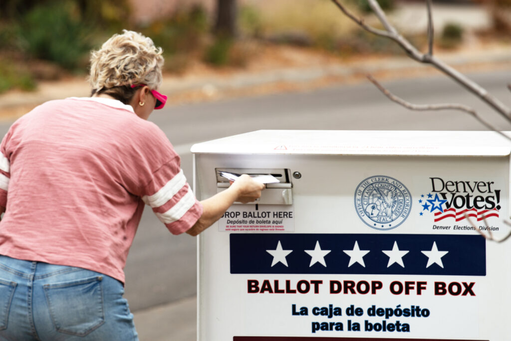
Communities across Colorado voted on ballot issues | Cronin and Loevy
Tom Cronin Bob Loevy
tom-cronin-bob-loevy@coloradopolitics.com
Updated 6 days ago
By Tom Cronin and Bob Loevy The results of the November 2025 odd-year elections are well known. Democrats easily won the Virginia and New Jersey governor elections and, in a number of other state elections, bested the Republicans. In Colorado, the big 2025 election news...
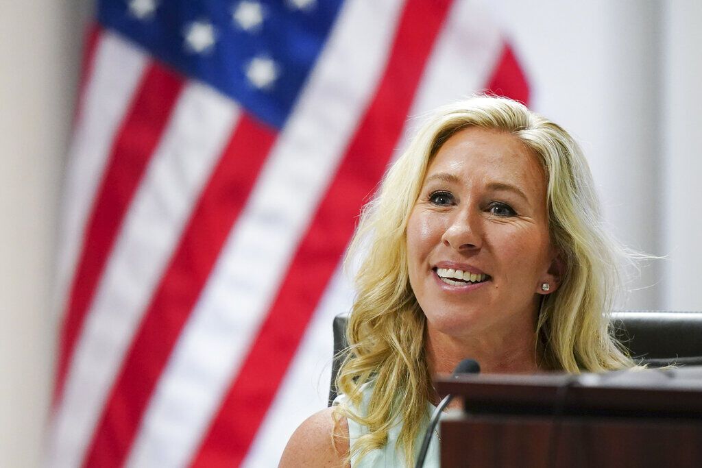
Rep. Marjorie Taylor Greene of Georgia says she is resigning from Congress
Michelle L. Price
michelle.l..price@associatedpress.com
Updated 6 days ago
WASHINGTON — Rep. Marjorie Taylor Greene of Georgia, a supporter of President Donald Trump who has become a critic, said Friday she is resigning from Congress in January. Greene, in a more than 10-minute video posted online, explained her decision,...

Colorado ballot measure for tougher fentanyl penalties moves forward
Marissa Ventrelli
marissa.ventrelli@coloradopolitics.com
Updated 7 days ago
A proposed measure that would increase penalties for fentanyl manufacturing, distribution and possession has collected enough signatures to qualify for the 2026 ballot, following several failed attempts by the state legislature to pass similar legislation. Backed by Advance Colorado, the...
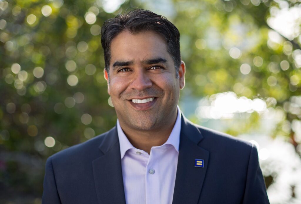
Democrat Kubs Lalchandani kicks off campaign for open CU regent seat in Colorado’s 2nd CD
Ernest Luning
ernest.luning@coloradopolitics.com
Updated 1 week ago
Boulder Democrat Kubs Lalchandani, an attorney and serial entrepreneur, has thrown his hat in the ring for the open University of Colorado Board of Regents seat representing the 2nd Congressional District in next year’s election. The incumbent, Democrat Callie Rennison,...
Colorado Republicans call meeting to rein in chair Brita Horn, but state GOP says plans are ‘illegal’
Ernest Luning
ernest.luning@coloradopolitics.com
Updated 1 week ago
They’re at it again. For the second time in as many years, a group of Colorado Republicans are planning to convene a meeting of the party’s state central committee despite the state GOP insisting that the proposed meeting would be...

Why winning as an independent remains a long shot, despite Colorado voters fleeing the two major parties
Marissa Ventrelli
marissa.ventrelli@coloradopolitics.com
Updated 2 weeks ago
When Yemi Mobolade won the Colorado Springs mayor’s race in 2023, he made history as the city’s first independent leader — and gave new hope to voters frustrated with America’s two-party politics. But even as unaffiliated voters now make up...
PREV
PREVIOUS
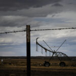
Why is Aurora in drought, but not Denver?
While the city of Aurora already implemented drought restrictions for 2023, next door, the city of Denver doesn’t expect to declare a drought this year. The tale of two cities left some in Aurora scratching their heads, and the city’s drought restrictions garnered pushback from at least two of the city’s councilmembers. Aurora poised to […]

Colorado Springs lawmakers clash over banning corporal punishment in schools | FOCUS ON THE SPRINGS
Rep. Regina English’s bill to prohibit corporal punishment in schools and child care centers cleared the House this week – but not before she battled it out with fellow lawmakers from the Colorado Springs delegation. If passed into law, House Bill 1191 would ban willfully causing physical pain to a child as punishment by employees […]