

Official damage assessment totals for Cameron Peak Fire released
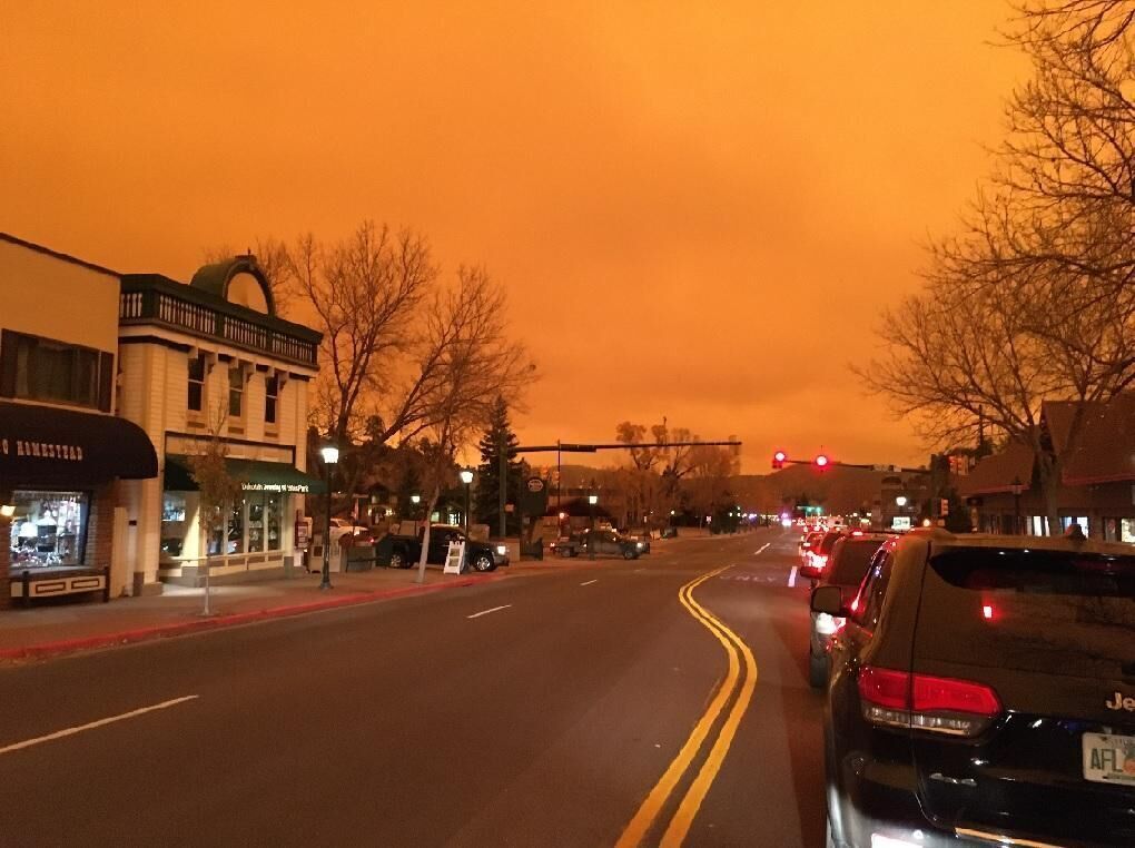
The Larimer County Sheriff’s Office took to Facebook on Friday afternoon to share the Cameron Peak Fire Damage Assessment Totals after damage assessment teams completed their assessment of all known structure damage caused by the 208,913-acre blaze.
A total of 469 structures were damaged, including 461 structures that were destroyed. Included in the structures that were destroyed were 224 residential structures and 220 outbuildings. Seventeen business structures were impacted and four additional homes and outbuildings, each, sustained damage. Forty-two of the residential structures that were impacted were considered primary residences.
The report also dates when damages occurred. On September 7, the blaze burnt the Poudre Canyon, south of Highway 14 near Archer’s Poudre River Resort, and the Monument Gulch area. On September 25 and 26, the blaze burnt Poudre Canyon between the Fish Hatchery and Rustic, the Manhayyan Road area, and the Boy Scout Ranch Road area. On October 14, the blaze burnt the Upper and Lower Buckhorn areas, Crystal Mountain, Bobcat Ridge, Buckskin Heights, Redstone Canyon, Storm Mountain, The Retreat, and Pingree Park.
Though not included in the structure damage report, it’s worth noting that the Cameron Peak Fire also burnt into the northern area of Rocky Mountain National Park. Specific damages that occurred there have not been released.
The Cameron Peak Fire blaze has calmed down substantially in recent weeks and is currently at 92 percent containment. The fire sparked on August 13 with the cause remaining under investigation.

Overdose deaths from opioids dip in America — but not in Colorado, study says
Jacob Mauk
jacob.mauk@denvergazette.com
Updated 1 hour ago
Overdose deaths from opioids rose in Colorado, diverging from the national trend, which has been decreasing, according to a new study from a think tank. In its new report, the Common Sense Institute said synthetic opioid overdose deaths in Colorado...
Colorado voters will decide whether transgender students can join girls’ sports
Marissa Ventrelli
marissa.ventrelli@coloradopolitics.com
Updated 2 minutes ago
A ballot initiative that would require student athletes to only join sports teams that correspond to their biological sex has qualified for the November ballot, the latest development in the culture war being waged in school districts, in the courts...
Error-prone Douglas County judge triggers another reversal of criminal convictions
Michael Karlik
michael.karlik@coloradopolitics.com
Updated 3 hours ago
Colorado’s second-highest court overturned a defendant’s Douglas County convictions on Thursday due to the error of a judge whose actions have triggered a disproportionate number of reversals to convictions and sentences in recent years. Since 2021, the Court of Appeals...
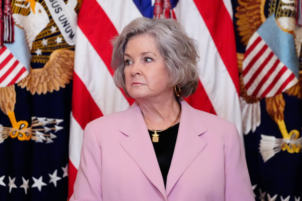
Susie Wiles diagnosed with ‘early stage’ breast cancer: Trump
David Zimmermann Washington Examiner
davidzimmermannwashingtonexaminer@wpstage.coloradopolitics.com
Updated 5 hours ago
President Donald Trump announced White House chief of staff Susie Wiles has been diagnosed with “early stage” breast cancer and that she decided to take on the illness immediately. Wiles will not step down from her administrative role at this...
Hacked crosswalks in Denver sound anti-Trump messages
Deborah Grigsby
deborah.smith@denvergazette.com
Updated 4 hours ago
Denver pedestrians got a surprise this weekend when the audio messages from push-button speakers on some crosswalks were mysteriously replaced with anti-President Donald Trump messages. “The walk signal is on, Trump … (reference to the Iran school that was bombed),”...

Federal judge formalizes injunction blocking USDA’s ‘pilot project’ for Colorado food assistance
Michael Karlik
michael.karlik@coloradopolitics.com
Updated 3 hours ago
A federal judge formalized his order on Monday to prevent the U.S. Department of Agriculture from requiring Colorado to participate in a food assistance “pilot project,” finding that it violates the law, the U.S. Constitution, and “the bounds of reasoned...

Colorado justices speak about inner workings of court, analysis of appellate opinions | COURT CRAWL
Michael Karlik
michael.karlik@coloradopolitics.com
Updated 8 hours ago
Welcome to Court Crawl, Colorado Politics’ roundup of news from the third branch of government. Members of the state Supreme Court provided an inside look at the workings of their institution, and a Colorado Politics analysis found that some appellate...

Appeals court finds no requirement for different judge to handle attorney-client conflict hearings
Michael Karlik
michael.karlik@coloradopolitics.com
Updated 8 hours ago
Colorado’s second-highest court rejected a defendant’s argument on Thursday that a judge improperly heard about a potential conflict between himself and his lawyer right before sentencing, and the man’s reaction could have “tainted” the sentencing decision. In September 2023, Anthony...
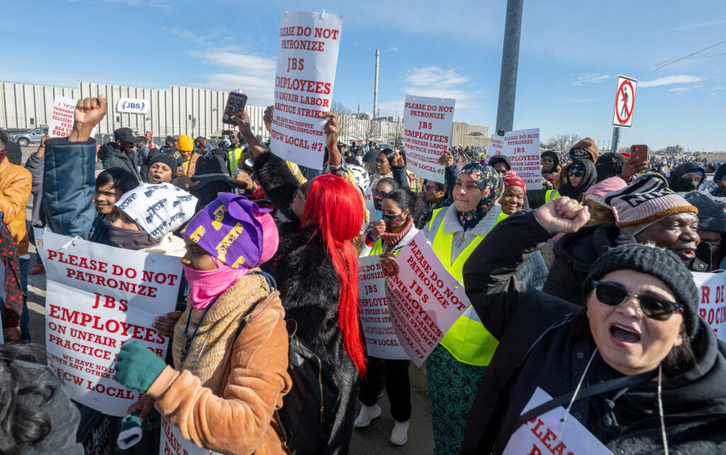
3,800 Colorado workers are on strike at JBS, one of the largest meatpacking plants in the US
Brittany Peterson
brittany.peterson@associatedpress.com
Updated 2 hours ago
GREELEY, Colo. (AP) — About 3,800 workers at one of the nation’s largest meatpacking plants went on strike Monday in Colorado in what union representatives said was the first walkout at a U.S. beef slaughterhouse in four decades. Hundreds of...
The influencers? Some Colorado appeals judges outpace colleagues in setting legal precedent
Michael Karlik
michael.karlik@coloradopolitics.com
Updated 8 hours ago
A handful of judges on Colorado’s second-highest court are producing substantially more precedent-setting opinions than their colleagues, which create binding interpretations of the law that reach beyond individual cases. The Court of Appeals issues approximately 1,700 opinions each year. A...
PREV
PREVIOUS

ELECTION 2020 | The winners and losers of the season that never ends
As the counting wraps up and decisions become decree, Colorado voters turned out in record numbers to make their choices known on Tuesday. The Colorado Politics staff offers their takes on who came out on top in the “most important election of our lifetime” (this year, anyway). Winners Kent Thiry: The retired Davita CEO turned […]

Coronavirus in Colorado: The latest numbers
There are now 9,707,096 coronavirus cases in the U.S. and 235,761 deaths, according to Johns Hopkins University. The latest COVID-19 numbers in Colorado (Updated on Nov. 6): – 121,006 cases, including 21,546 in Denver County – 1,279,847 people tested – 2,353 deaths among cases, including 455 in Denver County – 1.94% fatality rate in the […]