

Water Sage provides clarity on murky water rights issues
Elected officials looking to navigate Gov. John Hickenlooper’s Colorado Water Plan may be able to find help in the form of a new online water rights mapping tool called Water Sage.
Ponderosa Advisors, LLC recently unveiled new improvements to WaterSage.com following the rollout of the governor’s much-anticipated statewide water plan, which is designed to tackle issues created by the state’s growing population and increased demands on water resources across the west. Water Sage’s online, map-based program is designed to help stakeholders – including landowners, lawyers, water planning officials and others – gain greater access to information concerning water rights.
“We think that office holders at both the state and local level will find Water Sage extremely valuable,” said Kelly Bennett, Director of Research and Analysis and a Managing Partner at Ponderosa Advisors. “We hope our program and the consulting services we offer are able to help anyone in need of navigating Colorado’s complex water rights system.”
Several state agencies are responsible for publishing water data, and the state is often hailed as doing an exceptional job at gathering and publishing an abundant amount of information; but converting that data into a meaningful analysis can be cumbersome, if not impossible. “Colorado is light years ahead of other states in publishing large raw data sets for water, and helping private entities use that data,” says Bennett. “With the help of leading water analysts, lawyers, technical experts, and our development team, Water Sage takes that raw data and presents it in a single, user-friendly platform which virtually anyone can use.”
Among the new features recently added to the Water Sage platform is an integration of Colorado’s network of stream gauges, which will serve to improve the product’s analytical capabilities. “This gives users the ability to search and sort through thousands of stream gauges in the state and conduct flow analysis in real time,” said Bennett. “It is all about consolidating these different data sets.”
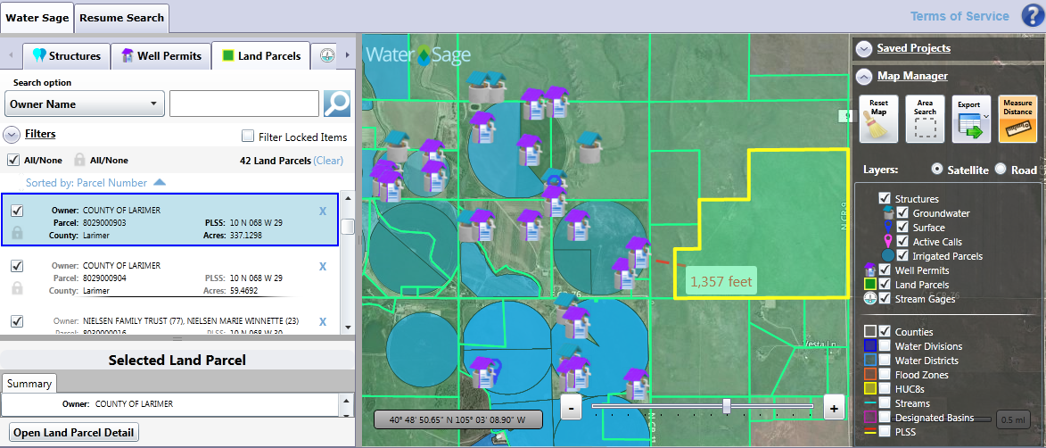
Users of WaterSage.com can search either spatially or by attribute for water rights, well permits and land parcels, and instantly view results with detailed data by individual or company name, or by structure. Data can also be exported into GIS compatible formats and be used with mobile devices. In essence, water research that previously could take days to perform – requiring specialized technical skills, visits to county courthouses and state agencies – can now take only minutes. It is enhancing the way water professionals, engineers, and local officials look at water-related issues today.
“We think Water Sage is the best demonstrative tool available to understand water issues in Colorado,” says Bennett. “As you start to go through the policy issues that will be part of the implementation of the new state water plan, this will prove to be a useful platform for all users, professionals and novices alike.”Users of the new program appear quick to agree. “Water Sage is a useful tool that allows staff to quickly and easily discuss water supply requirements for new developments,” says Tim Murrell, Water Resources Planner for Douglas County. “We use Water Sage to get the whole picture, from land parcel size and ownership, to in-depth information on both permitted and adjudicated water use. Water Sage is an extremely useful tool that helps us to continue to promote smart and sustainable growth throughout the county.”Some of the most germane questions that Water Sage could shed light on pertain to ownership of water rights. Like any other private property right, water rights can be bought, sold, inherited, and, of course, violated. Unlike other types of property however, water is a usufructuary right – that is, a right to use it, not to possess it. That means that a water right does not convey to its owner a particular volume of water to use as that owner pleases, but rather grants the owner the right to divert water for a beneficial use. Colorado law has defined “beneficial use” rather broadly, but does explicitly prohibit waste and speculation.In Colorado, water rights are confirmed by the judicial branch through water courts, an institution unique to Colorado. Typically, when someone wishes to apply for a water right, they must initiate a legal action with the state water court to determine if they have met the pertinent legal requirements for establishing a water right. The challenge facing water planners around the state is the fact that nearly every river in the state is over-allocated – meaning that the combined rate of all established and vested water rights exceed the available flow of the river being appropriated.
In Colorado, water rights are generally conveyed like real estate – by deed recorded with the county where the rights are located. While Water Sage was developed to research water rights, it doubles as a mitigation risk tool; it maps every diversion point in Colorado and is a quick and easy insurance policy for anyone who simply needs to know about water rights and where they flow on a particular land parcel.
Denver Water, the City of Boulder and Douglas County are among the local entities who have tapped the power of Water Sage. Cities and counties looking for economical and efficient ways to address water supply planning, infrastructure development, multi-stakeholder collaboration and water right portfolio management are using Water Sage as a single-source tool and utilizing the program to better serve their communities and save on administrative costs.
But it isn’t just water planners and officials who are finding Water Sage beneficial as they navigate complicated regulations, and it isn’t just Coloradans. Water Sage has also built platforms in Montana, Wyoming and Texas and is finding traction with consultants and local and state government agencies, engineers, lenders, appraisers, attorneys, title companies, conservation organizations, land brokers, industry, utilities, landowners and prospective land purchasers to research water rights in the United States.
“If you want to see what other states are doing with water, the user experience remains the same,” says Bennett.
“We believe that maximizing research efficiency and delivering insight will not only save users time and money, but give them an information advantage,” Bennett added. “Whether it’s understanding the value or usability of water and land, or finding water rights where you need them, Water Sage enables better water-related decisions.”
Water Sage offers hour-long and annual access licenses to our state-specific, map-based data portals and is looking to expand into other Western states.
Planned legislation outlines $300M deal for Pinnacol to break from state
Marianne Goodland
marianne.goodland@coloradopolitics.com
Updated 32 minutes ago
Colorado lawmakers are weighing a proposal that would allow Pinnacol Assurance to sever its remaining ties to the state in exchange for a $300 million payment, a long‑debated shift that supporters say could stabilize the insurer’s future and help plug...
Legislation requiring employers to grant unpaid leave to Colorado lawmakers heads to governor’s desk
Marissa Ventrelli
marissa.ventrelli@coloradopolitics.com
Updated 1 hour ago
Colorado lawmakers are one step away from securing guaranteed unpaid leave from their day jobs during the legislative session, after the House narrowly approved a proposal Thursday aimed at making it easier for working‑class residents to serve in the General...
Redistricting fight escalates as Colorado Title Board clears competing ballot proposals
Marianne Goodland
marianne.goodland@coloradopolitics.com
Updated 44 minutes ago
Colorado’s title board on Wednesday gave final approval to multiple ballot measures related to congressional redistricting, setting up a series of proposals that could alter how the state draws its U.S. House districts for the 2028 and 2030 elections. The...

Trump downplays major reform bill and says housing is ‘all about interest rates’
Zach Halaschak, Washington Examiner
zach.halaschak.washington.examiner@gazetteedit.wpenginepowered.com
Updated 2 hours ago
President Donald Trump downplayed the bipartisan housing legislation that many congressional allies hope will ease the affordability worries plaguing voters, saying instead in an exclusive Washington Examiner interview that housing is “all about interest rates.” Trump said on a phone call Thursday morning...
Colorado lawmakers propose deep cuts to close $1.2B budget gap
Marianne Goodland
marianne.goodland@coloradopolitics.com
Updated 2 hours ago
The panel of Colorado legislators in charge of crafting next year’s budget has finalized the 2026–27 spending plan built on deep cuts and one‑time cash transfers in an attempt to close a shortfall of more than $1.2 billion. The plan...

Denver judge denies Gov. Polis request to dismiss ICE-related records case
Marianne Goodland
marianne.goodland@coloradopolitics.com
Updated 2 hours ago
A year after blocking the release of state records to federal immigration agents, a Denver judge has now denied Gov. Jared Polis’ effort to end the lawsuit at the center of the dispute. The lawsuit filed against the governor in...
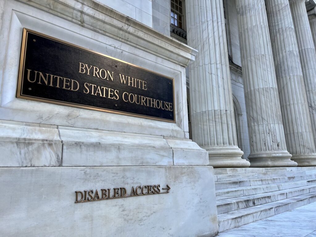
10th Circuit grants rare all-judges’ review of Colorado banking regulation
Michael Karlik
michael.karlik@coloradopolitics.com
Updated 4 hours ago
The Denver-based federal appeals court announced on Thursday that it will hold a rare all-judges review of a recent decision that permits Colorado to require out-of-state banks to abide by the state’s maximum interest rates when they lend to in-state...
Colorado appeals court orders new sentencing for Tina Peters, upholds convictions
Michael Karlik
michael.karlik@coloradopolitics.com
Updated 5 hours ago
Colorado’s second-highest court determined on Thursday that a trial judge improperly sentenced former Mesa County clerk Tina Peters based upon her exercise of protected speech, while at the same time upholding her convictions. The three-judge Court of Appeals panel also...

Denver promised every school funding from $1B bond — but campuses later closed received far less | Analysis
Nico Brambila
nico.brambila@denvergazette.com
Updated 3 hours ago
Denver voters overwhelmingly approved the largest bond measure in Denver Public Schools history on the promise that every school — including charter campuses — would receive something. And they did. But the nearly $1 billion bond was not distributed evenly....
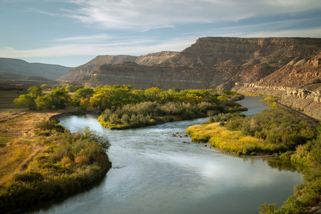
National conservation area growing by 4,000-plus acres in western Colorado
Seth Boster
seth-boster@coloradopolitics.com
Updated 7 hours ago
A formerly private, sweeping swath of western Colorado is growing a public, red rock wonderland. Spanning 4,000-plus acres, Escalante Ranch has been transferred to the Bureau of Land Management and incorporated into Dominguez-Escalante National Conservation Area, The Conservation Fund recently...
PREV
PREVIOUS

Group looks to turn up heat on Crowder, any other would-be ‘constitutional arsonist’
The rolling skirmish over a plan to rework the state’s hospital provider fee at the Legislature is intensifying, even in the absence of any legislation for the opposing parties to wrangle over. Conservative advocacy group Advancing Colorado unleashed a broadside Wednesday against state Sen. Larry Crowder, R-Alamosa, who has signaled he may be open to […]

Leonard, Merkel, Shuler among Keyser vacancy candidates
Two former state Senate candidates and a longtime party volunteer are among the Republicans applying to fill the House District 25 vacancy created when state Rep. Jon Keyser, R-Morrison, announced he would be resigning to run for the U.S. Senate. Applicants for Keyser’s seat, which covers the Jefferson County Foothills, include Evergreen real estate developer […]