

Feds announce less drastic steps to stave off Colorado River shortages

Last winter’s better-than-average snowfall, coupled with promises of less water use by Arizona, California and Nevada, means less drastic actions between now and 2026 for the Colorado River from the U.S. Bureau of Reclamation.
Water experts welcomed the news, which prompted officials in Arizona to describe the river system as “stable.”
The federal agency on Wednesday announced it is revamping its plans for shoring up water levels at Lake Mead and Lake Powell, based on a new analysis of the river’s hydrology and the promises by the three Lower Basin states to reduce their water usage by 3 million acre-feet over the next three years.
One acre-foot is about 326,000 gallons – enough to supply two families of four for a year.
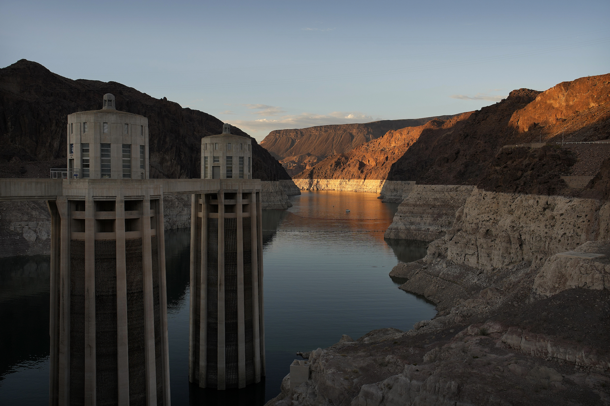
The drive to conserve on the Colorado River is prompted by more than 20 years of historic drought, which means the river is no longer able to handle the demands to deliver water to the seven states’ 40 million people and keep agriculture, particularly in California, thriving. The shortages also raised concerns that, without drastic action, Hoover and Glen Canyon dams would struggle to supply hydropower to Western states.
The 1922 Colorado River compact and subsequent agreements dictate the three Lower Basin states receive 7.5 million acre-feet of water per year from the Colorado, and the same amount to the four Upper Basin states, although hydrology shows in some years it barely can supply more than 10 million acre-feet to the entire system.
Last April, the bureau issued a draft “Supplemental Environmental Impact Statement,” which said water levels in the two reservoirs would drop to critically low points without additional action.
That was based on a hydrology analysis from Sept. 2022 that estimated chances of Lake Powell dropping below its critical elevation level of 3,490 feet above sea level at 57%. Meanwhile, experts estimated Mead’s chances of going below its critical elevation of 1,000 feet at 52%. Both of those levels are required to generate hydropower at the reservoirs’ two dams.
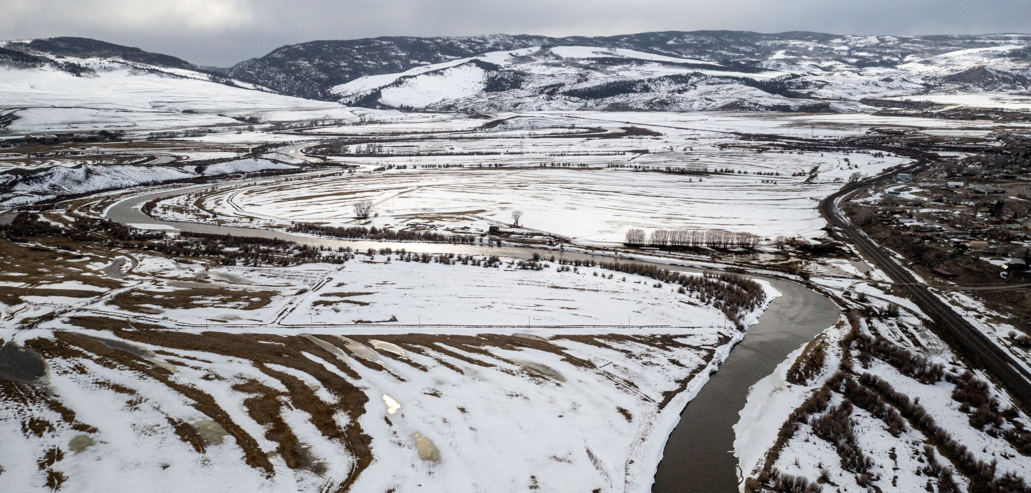
As of Oct. 26, Lake Powell’s water levels stood at 3,572.4 feet and 36% full. That’s 42 feet higher than a year ago. Lake Mead is at 1,065.8 feet, almost 20 feet higher than a year ago, and is about 34% full.
The April draft statement contained two alternatives, plus a “no action” option.
The first modeled “progressively larger additional shortages as Lake Mead’s elevation declines, and larger additional shortages in 2025 and 2026, as compared with 2024.” The second modeled releases from Glen Canyon Dam at Lake Powell, plus an analysis of the effects of additional Lower Colorado River Basin reductions “that are distributed in the same percentage across all Lower Basin water users under shortage conditions.” Alternative 2 would also make progressively larger reductions in Colorado River allocations to the Lower Basin states in 2025 and 2026.
Those cuts would fall primarily on California and Arizona, with Arizona taking a bigger hit because its water rights are junior to that of California’s.
Just a month after the draft statement came out, the Lower Basin states agreed to reduce their use of Colorado River water, although far below the 4 million acre-feet in annual reductions from all seven states that Reclamation Commissioner Camille Calimlim Touton said in a June 2022 U.S. Senate hearing she wanted.
The Upper Basin states of Colorado, New Mexico, Utah and Wyoming asked the bureau to review the proposal from the Lower Basin states but notably did not endorse it, saying they did not see the plan in time to review it.
That agreement also prompted the bureau to withdrew its draft “Supplemental Environmental Impact Statement.”
Then the winter of 2022-23 arrived, bringing much heavier snowfall in the Colorado River basin states than anticipated.
Touton called the snowfall “an unexpected gift” in an interview with Colorado Politics in June. She noted the agreement from the Lower Basin states to reduce their use would buy time for conversations around the future, including the 2026 renegotiation of operating guidelines for the Colorado River.
She added the bureau, along with the Lower Basin states, would carefully watch how the reductions perform and whether they protect the system.
In June, the bureau also updated its hydrology analysis to incorporate the effects of the 2022-23 snowfall.
That new analysis showed the chances of levels at Powell dropping below its critical elevation level of 3,490 feet at 8%, a far cry from the previous estimate. For Lake Mead, the chances of dropping below 1,000 feet now stood at 4%.
In Wednesday’s announcement, Deputy Secretary of the Interior Tommy Beaudreau said, “Throughout the past year, our partners in the seven Basin states have demonstrated leadership and unity of purpose in helping achieve the substantial water conservation necessary to sustain the Colorado River System through 2026.”
“Thanks to their efforts and historic funding from President Biden’s Investing in America agenda, we have staved off the immediate possibility of the System’s reservoirs from falling to critically low elevations that would threaten water deliveries and power production,” Beaudreau added.
Arizona’s Department of Water Resources declared the river system “stable” in a statement on Wednesday. By the end of 2023, the Lower Basin will have voluntarily conserved more than 1 million acre-feet in the Colorado River system, water officials there said.
“As a result of the conservation and the reductions in use, Arizona, California and Nevada this year have put just 5.8 million acre-feet to consumptive use – the lowest consumptive use since 1984,” the department said.
Arizona’s efforts alone have been substantial, conserving more than 3.7 million acre-feet of water in Lake Mead since 2014, the department added. In 2023 alone, Arizona is on track to conserve 907,000 acre-feet.
State officials there said that, taken together, the voluntary commitments are “on track” to achieve the volumes in the Lower Basin consensus proposal offered to the federal government earlier this year.
“Combined with the past year’s above-average hydrology, the system is stable through 2026,” the Arizona agency said. “As a result, the states will continue focusing their efforts on post-2026 operational guidelines in order to stabilize the Colorado River system for the long-term.”
But attorney Kirk McGill from Hall Estill is less than impressed with Wednesday’s announcement.
“First, this was hardly a voluntary action by the states involved – they either had to get an agreement together or risk a plan being imposed upon them by the federal government followed by years of expensive lawsuits,” he said. “And they were only able to get a deal – thanks to the good winter snowpack in the Rocky Mountains, a matter of luck rather than design.”
“Additionally,” he told Colorado Politics, “the plan only covers the next three years, and the hardest work – long-term conservation beyond 2026 – has yet to be tackled.”
McGill said the agreement “merely buys” the states and the federal government three years to get a long-term plan in place, with “every prospect of that not occurring leading to lengthy legal battles in the courts and further short-term stop-gap measures to stave off disaster.”
McGill added that he still sees “no sign of recognition that continuing to build communities in arid regions entirely dependent on upstream sources of waters is not environmentally sustainable.”
The updated “Supplemental Environmental Impact Statement” – which now has the two earlier action alternatives, a new one based on the agreement from the three Lower Basin states and the updated hydrology analysis – will now go through a 45-day comment period.

Judge rules that Colorado law makes it too hard for parties to bar unaffiliated voters from primaries
Ernest Luning
ernest.luning@coloradopolitics.com
Updated 1 hour ago
A federal judge ruled in favor of the Colorado Republican Party late Tuesday, saying that a portion of the state law that allows unaffiliated voters to cast ballots in party primaries is unconstitutional because it imposes an unrealistic burden on...
10th Circuit upholds regulator’s methodology for Tri-State exit fees
Michael Karlik
michael.karlik@coloradopolitics.com
Updated 2 hours ago
The Denver-based federal appeals court upheld a regulatory agency’s methodology for calculating the fee owed by entities seeking to withdraw from Tri-State Generation and Transmission Association last week. Tri-State is a Westminster-based cooperative that provides and transmits electricity to member...
Federal judge proposes sanctions against Mike Lindell’s lawyers for continued fake citations
Michael Karlik
michael.karlik@coloradopolitics.com
Updated 3 hours ago
A federal judge is once again pursuing sanctions against lawyers for MyPillow CEO Mike Lindell for continuing to cite to court cases that do not exist, likely based on the faulty output of artificial intelligence tools. Last year, a jury...
Front Range cities oppose Democratic proposal to permit lot‑splitting as a path to affordable housing
Marianne Goodland
marianne.goodland@coloradopolitics.com
Updated 3 hours ago
Colorado lawmakers are pressing ahead with a plan to let homeowners split their lots to make room for smaller, more affordable houses. The proposal has drawn sharp opposition from Aurora, Colorado Springs, Denver and other Front Range cities that argue...
Susan Blanco signals views on role of appellate courts in first opinion as Colorado justice
Michael Karlik
michael.karlik@coloradopolitics.com
Updated 7 hours ago
Justice Susan Blanco’s first solo opinion as a new member of the Colorado Supreme Court made clear her view of the guardrails that keep the state’s highest court tethered to the issues it is asked to decide. On Monday, the...

Hegseth features Fort Carson soldiers after returning from Middle East, gives warning on Iran war
Reuters
reuters@gazette.com
Updated 7 hours ago
Defense Secretary Pete Hegseth said on Tuesday the next few days in the war against Iran would be decisive and warned Tehran that the conflict would intensify if it did not make a deal. Hegseth also highlighted his trip to the Middle...

Denver Council narrowly approves deal with Axon
Deborah Grigsby
deborah.smith@denvergazette.com
Updated 11 hours ago
After weeks of delay, the Denver City Council narrowly approved a one-year $150,000 contract with Axon for 50 automated license plate-reading cameras and the necessary system hardware, replacing the city’s former vendor, Flock. The 7-6 vote came during Tuesday’s regular...
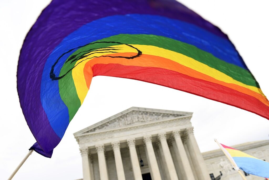
Colorado leaders weigh next steps after Supreme Court rejects state ban on ‘conversion therapy’
Marissa Ventrelli
marissa.ventrelli@coloradopolitics.com
Updated 1 day ago
Colorado leaders said they are weighing next steps after the U.S. Supreme Court on Tuesday rejected the state’s ban on “conversion therapy” for children, as critics and supporters cheered or lambasted the ruling. The court’s near-unanimous decision called the Colorado...
Aurora homeless shelter opened too early, CEO says, as mold and plumbing issues emerge
Kyla Pearce
kyla.pearce@gazette.com
Updated 11 hours ago
Aurora’s largest homeless services project launched “way too early,” its CEO told city leaders Tuesday, saying the rushed opening left residents living amid mold, plumbing failures, and other issues inside the former hotel. During Tuesday’s Housing, Neighborhood Services and Redevelopment...
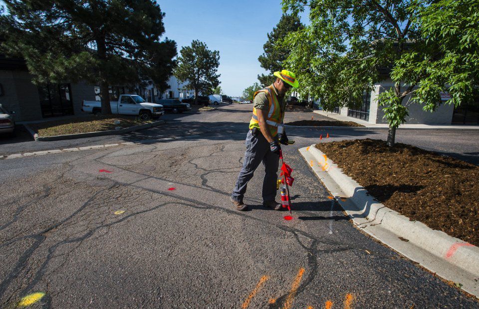
Gov. Polis declares April ‘dig safely month’ to mark 40th anniversary of Colorado 811
Scott Weiser
scott.weiser@gazette.com
Updated 10 hours ago
Gov. Jared Polis declared April 2026 as “Dig Safely Month” in Colorado, an annual observance that this year highlights the 40th anniversary of Colorado 811, the state’s One-Call Notification System. “Before everyone starts their warm weather projects around the house,...
PREV
PREVIOUS

Denver residents, councilmembers insist $17.5 million for rental assistance will prevent homelessness
The majority of people who spoke on Denver’s proposed spending plan during Monday’s council meeting praised councilmembers’ push to earmark $17.5 million for the city’s rental assistance program, saying the latter helps to prevent homelessness. Denver Mayor Mike Johnston did not budge on his $12.6 million budget request when the council asked for additional funding. […]

Conservative candidates hold fundraising edge in Aurora City Council election
Conservative candidates hold the fundraising edge for all of the council races in Aurora – except in one contest. Ten candidates are running for five seats on the City Council this November. Up for election are two at-large positions and the seats in wards IV, V and VI. At-large candidates Aurora residents will chose two […]