

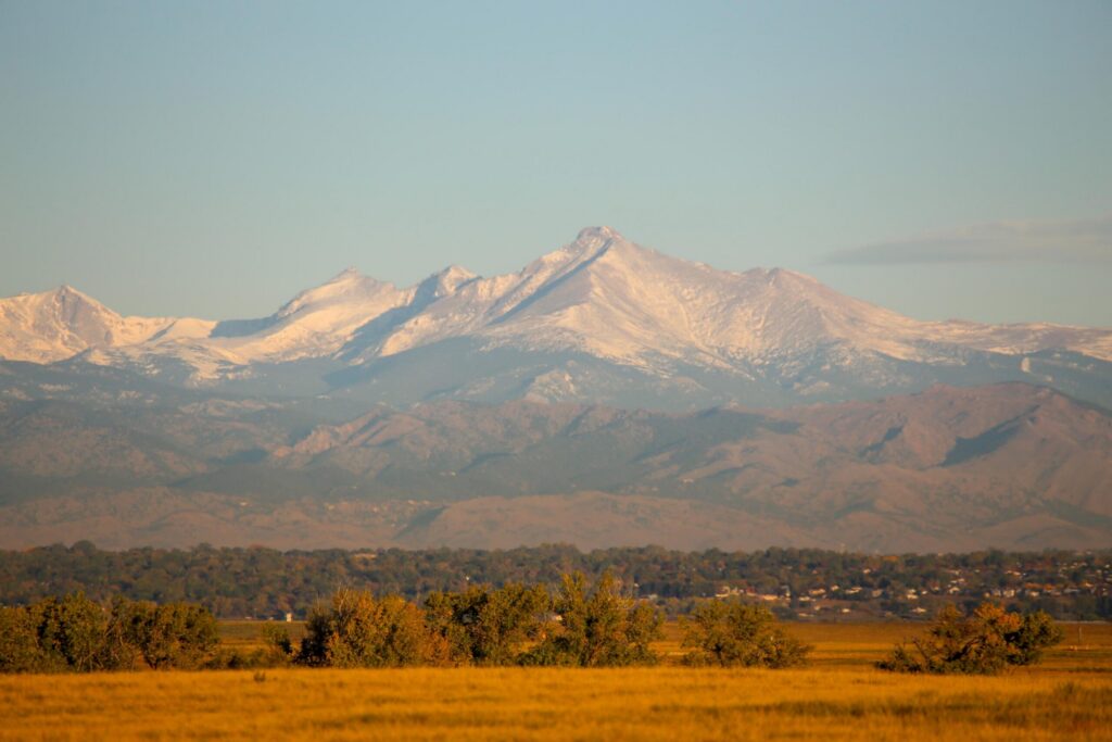
Colorado snowpack remains below normal, USDA report says

Colorado’s snowpack remains quite a bit off from normal, according a report Friday by the U.S. Department of Agriculture.
Colorado is at 90% of the to-date median and 83% of the median peak snowpack number, with the median date of that peak falling on April 8.
It’s unlikely the state will gain much ground toward reaching 100% of the median on either metric.
Data by the National Weather Service shows that Colorado has a slight chance of seeing above-norm precipitation during the middle of April, though the state is likely to see below-norm precipitation during much of the month after that.
A small amount of precipitation was expected to fall in the mountains on Saturday night, with the possibility of a couple inches accumulating on higher elevation peaks and ridges. Tuesday and Wednesday could bring a potentially significant storm to parts of the state. Exactly what this ends up looking like remains unclear, but blizzard conditions could be possible.
Kyle Mozley, a meteorologist with the National Weather Service in Pueblo, said Friday that it’s still too early to say what kind of the impact next week’s projected storm could have, but added that the mountains probably will see snow while the eastern plains are expected to remain dry.
Though April is typical one of the snowiest months of the year, Colorado Springs has not seen any significant snowfall so far.
The U.S. Drought Monitor shows, as of Friday, that about 83% of the state is experiencing drought conditions – compared to 92% this time last year.

Federal judge: Government violated order shielding man from deportation in ‘one-off mistake’
Michael Karlik
michael.karlik@coloradopolitics.com
Updated 1 hour ago
A federal judge acknowledged on Thursday that the government violated his order by deporting a man in immigration detention during his pending court case, but it “serves nobody’s interests” to require the government to return him. On Feb. 18, Tesfami...

Wolf depredation payouts in Colorado top $700K for 2025, double annual funding
Marianne Goodland
marianne.goodland@coloradopolitics.com
Updated 3 hours ago
The Colorado Parks and Wildlife Commission approved more than $706,000 in wolf depredation claims for 2025 during its March meeting last week, an amount that exceeds the state’s annual wolf compensation fund by more than double. The commission also rejected...

U.S. intelligence report suggests Iranian regime is not at risk of imminent collapse
Washington Examiner Staff, Washington Examiner
washington.examiner.staff.washington.examiner@gazetteedit.wpenginepowered.com
Updated 58 minutes ago
Washington Examiner Recent U.S. intelligence reports have assessed that after nearly two weeks of Operation Epic Fury, Iran’s government leadership is not in danger of imminent collapse. The evaluation comes after 12 days of regular military strikes by United States...

Colorado committee recommends rejecting alcohol, marijuana tax hike to fund mental health care
Marissa Ventrelli
marissa.ventrelli@coloradopolitics.com
Updated 4 hours ago
In a rare move, Colorado’s Capital Development Committee unanimously recommended that another legislative committee reject a bill asking voters to approve higher excise taxes on alcohol and marijuana to fund a new mental health hospital in Aurora. Sponsored by Rep....
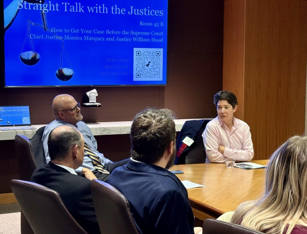
Colorado Supreme Court lifts curtain on decision-making at legal event
Michael Karlik
michael.karlik@coloradopolitics.com
Updated 5 hours ago
Members of the Colorado Supreme Court sat down with lawyers on Wednesday to answer questions about behind-the-scenes topics, including what happens immediately after an appeal is argued, why they might intervene in an ongoing case, and the consequence of a...

Senate, House leaders propose bill to cut outdated Colorado regulations and expand agency oversight
Marissa Ventrelli
marissa.ventrelli@coloradopolitics.com
Updated 5 hours ago
A bipartisan group of Colorado’s top legislative leaders is pushing a bill that would require periodic reviews of state regulations and expand lawmakers’ ability to scrutinize agency programs during oversight hearings. Senate Bill 137, sponsored by Senate President James Coleman,...
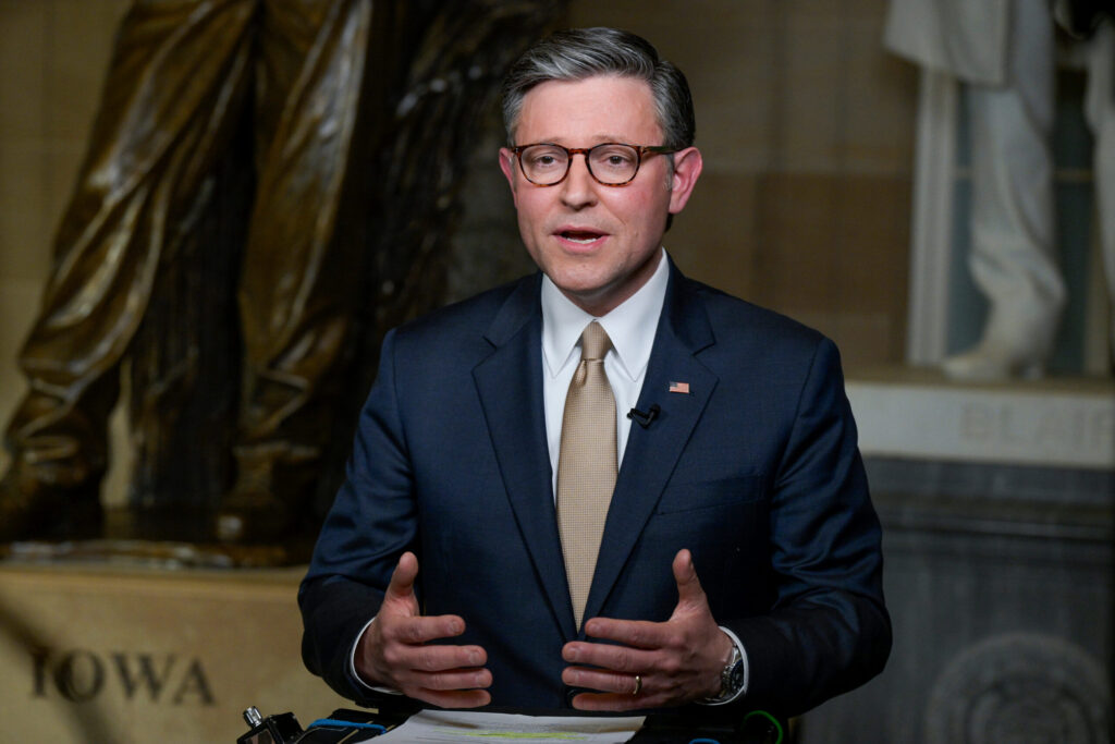
House Republicans split over SAVE America Act pressure campaign
David Sivak, Washington Examiner
david.sivak.washington.examiner@gazetteedit.wpenginepowered.com
Updated 8 hours ago
House Republicans are torn over how difficult to make life for the Senate as a band of rebels pressures Majority Leader John Thune (R-SD) to pass a national voter ID bill. Speaker Mike Johnson (R-LA) has cautioned House conservatives that...

Republican Jeff Crank, Democrat Jessica Killin qualify by petition for Colorado’s 5th CD primary
Ernest Luning
ernest.luning@coloradopolitics.com
Updated 8 hours ago
Republican U.S. Rep. Jeff Crank and Jessica Killin, one of the Democrats challenging the first-term incumbent, have both qualified for the primary ballot in Colorado’s 5th Congressional District after turning in a sufficient number of petition signatures, state election officials...
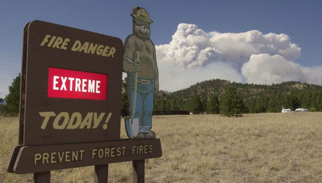
High winds force closures of I-25 and I-70, overturned semi-trucks, flight delays, power outages
Dan Boniface
dan.boniface@denvergazette.com
Updated 2 hours ago
High winds, warm temperatures and dry conditions have meteorologists sounding the alarm across much of Colorado on Thursday. Here’s what you need to know. Red Flag Warning issued The National Weather Service in Boulder has issued a Red Flag Warning...
This winter was Colorado’s warmest on record
Matt Kyle
matt.kyle@denvergazette.com
Updated 6 hours ago
Colorado just had its warmest winter on record, while the Denver metro area had its second-warmest, according to meteorologists and National Weather Service data. Data show the average temperature between December and February was 33.6 degrees, nearly 2 degrees warmer...
PREV
PREVIOUS
Weiser calls for stronger penalties for fentanyl possession ahead of bill's first hearing
Attorney General Phil Weiser’s office has discussed amending the legislature’s sweeping fentanyl bill with sponsors to tighten penalties around simple possession of the drug. A Weiser spokesman confirmed the discussions Friday, shortly after Colorado Public Radio reported that some Democrats in the capitol may try to amend a bipartisan bill to make it a felony […]

Former Trump advisor Kellyanne Conway headlines reception for Bennet challenger Gino Campana
Kellyanne Conway, the first woman to run a winning presidential campaign, is slated to appear at a reception for Republican U.S. Senate candidate Gino Campana Friday night in Colorado Springs ahead of the Colorado GOP’s state assembly. Conway, a veteran pollster and longtime advisor to former President Donald Trump, managed Trump’s 2016 presidential campaign and […]