

Heavy snowfall in late December, early January produces rare optimism from water watchers

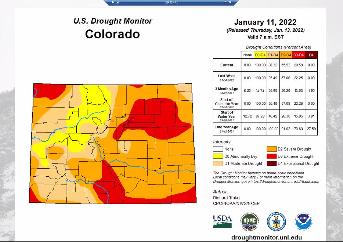
Snowfalls in late December and early January have resulted in some of the best snowpack conditions the state has seen in at least three years, according to state and federal water experts.
The Water Availability Task Force, a coalition of state and federal water and climate experts, as well as local water providers, reviewed the state’s water conditions Tuesday and delivered plenty of good news.
One area of the state not often mentioned by the group, Schoefield Pass, which connects the towns of Marble and Crested Butte, recorded almost 144 inches of snow during the Dec. 23 to Jan. 2 period.
Brian Domenesko, a hydrologist with the Natural Resources Conservation Services, a service of the US Department of Agriculture, said that snowfall produces 14.4 inches of water or about 12 feet by ski resort standards.
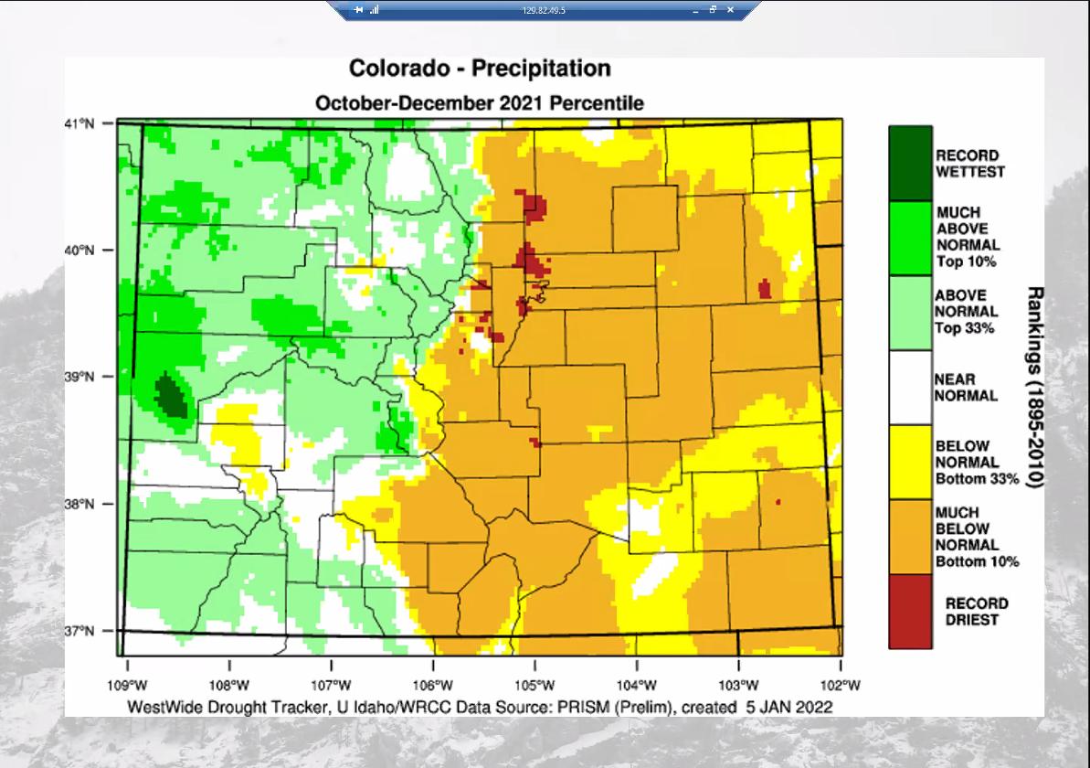
There was more good news, a welcome relief at a time when drought has been the long-term pattern. The state’s precipitation for calendar year 2021 was only about an inch below normal – not the record-breaking drought of the past few years, according to Peter Goble of the Colorado Climate Center.
The state had a rare combination of a warm and wet December, Goble said.
Winter was slow to start, and then it delivered big snows. That followed the warmest July to December on record, he said, about 1.3 degrees Fahrenheit warmer than average.
Goble noted that, at his home in Berthoud, December and January offered the first above normal precipitation since last May.
But not all was good news, particularly for southeastern Colorado.
Goble warned that the state could see a worse than normal brushfire season due to the warm, drying conditions from the summer. Those conditions set the stage statewide for the types of fires that took place in December, including the Marshall fire that tore through Louisville and Superior and destroyed more than 1,000 homes.
Those warm, dry conditions have also hurt soil moisture, with the worst conditions on the Eastern Plains, although for now soil moisture conditions are actually a little better than they were a year ago.
Statewide, according to Domonkos, snowpack is above normal, at 124% of median, largely due to the late December to early January snowfall. That translates to a 7-inch increase in water.
“It’s huge,” said. “It’s something we’ve wanted for several years.”

How big was that snowfall? On Dec. 1, the state was at 52% of median for snowpack.
In the San Juan basin, which includes the Dolores, San Miguel, Animas and San Juan rivers, the snowpack is in the best shape it’s been in for the last three years, Domonkos said, adding snowpack also is much improved in the Gunnison River Basin.
Those snowpack totals show “great potential runoff scenarios come spring,” he said.
The only place where snowpack is still below average, according to Domonkos, is in the Rio Grande River basin in the San Luis Valley and the lower Arkansas River basin.

Aurora seats new progressive council
Kyla Pearce
kyla.pearce@gazette.com
Updated 4 hours ago
Aurora’s four new councilmembers and an incumbent were sworn in Monday night, marking the beginning of a progressive-majority council rule in the city that has been led by conservatives for years. “This is what democracy looks like,” new at-large member...
Dean alleges firing over opposition to book ban in Elizabeth School District
Deborah Grigsby
deborah.smith@denvergazette.com
Updated 6 hours ago
A former Elizabeth Middle School dean of students has filed a lawsuit in federal court alleging she was terminated because of her opposition to the district’s book ban policy and her advocacy against “racism” in the school. On Nov. 30,...

Heading into holidays, shoplifting on the rise in Colorado, study says
Mark Samuelson Special to The Denver Gazette
mark.samuelson@denvergazette.com
Updated 7 hours ago
Shoplifting and other forms of retail crime are seeing a sharp rise as Colorado heads into the holidays, according to a study. After falling from a recent-record 24,975 thefts reported in 2015 to around 18,000 in 2021, Colorado Bureau of...
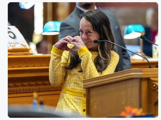
Funeral for Sen. Faith Winter will be held Friday at the Colorado Capitol
Marianne Goodland
marianne.goodland@coloradopolitics.com
Updated 7 hours ago
Colorado Sen. Faith Winter will be remembered on Dec. 5 at 2 p.m. in a funeral service on the state Capitol’s west steps. A celebration of life reception will follow. Winter died on Wednesday, Nov. 26, in a three-vehicle accident...
10th Circuit rules Greeley officer unconstitutionally detained man standing outside home
Michael Karlik
michael.karlik@coloradopolitics.com
Updated 7 hours ago
The Denver-based federal appeals court concluded last week that a Greeley police officer lacked reasonable suspicion to detain a man who was standing outside the door of a residence and not engaging in any indicators of criminal activity. A three-judge...

Copper Creek yearling wolf blamed for livestock death in Gunnison County
Marianne Goodland
marianne.goodland@coloradopolitics.com
Updated 8 hours ago
A heifer found dead in eastern Gunnison County on Nov. 22 was killed by one of the yearlings from the Copper Creek wolf pack, according to a rancher, who did not want to be identified. It’s the fourth livestock death...

‘Utterly no precedent’: Federal judge expresses concerns about Jeffco’s early appeal in jail death case
Michael Karlik
michael.karlik@coloradopolitics.com
Updated 7 hours ago
A federal judge shared his concerns on Monday about Jefferson County’s appeal of a routine procedural order in a constitutional rights case, which the plaintiffs argued could spawn appeal-related delays in countless lawsuits against the government. During a hearing, U.S....

Justice Hart’s absence continues, state Supreme Court hears oral arguments | COURT CRAWL
Michael Karlik
michael.karlik@coloradopolitics.com
Updated 11 hours ago
Welcome to Court Crawl, Colorado Politics’ roundup of news from the third branch of government. One member of the Colorado Supreme Court remains on an unusual leave of absence, plus the court heard oral arguments in eight more cases last...
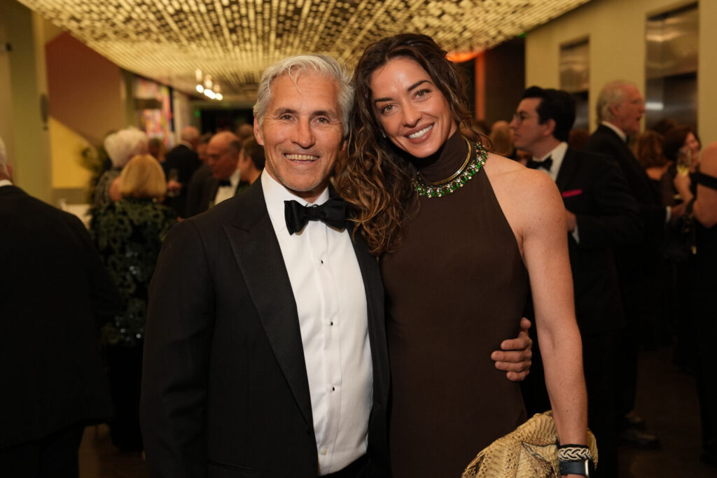
Denver Art Museum gala honors treasured benefactors Kent and Vicki Logan | NONPROFIT REGISTER
Joanne Davidson Special to Colorado Politics
joanne-davidson-special-to-colorado-politics@coloradopolitics.com
Updated 11 hours ago
DENVER ART MUSEUM Denver News: Kent and Vicki Logan, who 25 years ago made the largest gift in the history of the Denver Art Museum’s modern and contemporary art department, were the honorees when the DAM hosted the 43rd edition of its...

The Colorado Lottery’s mega-bad idea | Sondermann
Eric Sonderemann
eric-sonderemann@coloradopolitics.com
Updated 15 hours ago
There are plenty of lousy, miserable, misguided whims out there. Then, every so often, you come across a notion so wrong-headed that it qualifies as phenomenally bad. Or, in words the marketing whizzes at the Colorado Lottery might understand, let’s...
PREV
PREVIOUS

Children's Hospital sees record number of COVID-19 patients amid omicron surge
More kids are hospitalized at Children’s Hospital Colorado because of COVID-19 now than at any previous point in the pandemic, a surge fueled by the omicron variant and affecting young children at high rates. Patient volumes within the system are up across the board, from the emergency room to medical-surgical beds and the intensive care […]
KN95, surgical-grade masks will be available to all Coloradans
KN95 and surgical-grade masks will be available for free at libraries and other community centers across Colorado later this week as state officials try to curb the spread of COVID-19. The masks will be available at public libraries, fire stations, recreation centers, VFWs, YMCAs and community centers, the Colorado Division of Homeland Security and Emergency […]